AKÇATAS Village Digital Map | Mountains, Rivers and Elevation Details
Osmaniye ilinde,
Sumbas ilçesinde, köyler içinde,
En geniş aile yerleşimi listesinde 5. Akçataş sıralamada beşinci sırada yer almaktadır.
Ticarî yoğunluk açısından önde listesinde 3. Akçataş istatistik listelerinde 3. sırada yer almaktadır.
Arsa yatırımının en kazançlı olduğu listesinde 5. Akçataş sıralamada beşinci sırada yer almaktadır.
Dul oranı en belirgin olan listesinde 2. Akçataş 2. sırada kayıtlı, önemli bir yerleşimdir.
Üst yaş grubunda lider listesinde 3. Akçataş istatistik listelerinde 3. sırada yer almaktadır.
Sokak ağı güçlü olan listesinde 5. Akçataş 5. sırada kayıtlı ve dikkat çeken bir yerleşimdir.
| Adi | AKÇATAS Province Affiliated | OSMANIYE District Affiliated | SUMBAS Postal code | 80902 Number of Streets | 8 Population Density km2-people | 24.44 Number of Apartments with business Licenses | 28 Number of Apartments with Residential Licenses | 464 Number of Households / Families | 300 Total Population | 789 Male Population | 403 Woman Population | 386 Income Per Person - Spendable TL-Month | 4.039 |
|---|
AKÇATAS Village Map | Updated Neighbourhood Map
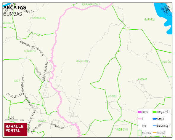
AKÇATAS Village Digital Map | Mountains, Rivers and Elevation Details
AKÇATAS Village – Population, Postal Code, Number of Workplaces
AKÇATAS village SUMBAS district of OSMANIYE province. UAVT (National Address Database Code) Village Code: 37309. Postal Code: 80902. AKÇATAS 8 streets and avenues, 28 independent business licensed apartments, 463 residential licensed apartments, 301 households. 795 people live in this settlement. 403 male, 392 female. 179 people have never married, 428 people are married, 30 people are divorced and 49 people have passed away. The number of people aged 60 and over is 218. The population rate of 60+ people is % 27 and the ratio of children under the age of 10 to the population is % 7 SUMBAS -in the district- 9. the most crowded neighbourhood.
Leave a Comment