AKPINAR Village Digital Map | Updated Neighbourhood Map
Adıyaman ilinde, köyler içinde,
Konut kapasitesi en geniş listesinde 2. Akpınar üst sıralarda konumlandı.
Dükkan ve işyeri bakımından ilk sırada listesinde 2. Akpınar zirveye en yakın konumda.
Merkez ilçesinde, köyler içinde,
Konut kapasitesi en geniş listesinde 1. Akpınar 1. sırada konumlanan mahalle olarak bilinir.
Dükkan ve işyeri bakımından ilk sırada listesinde 2. Akpınar 2. sırada kayıtlı, önemli bir yerleşimdir.
Toprak birim fiyatı en yüksek listesinde 1. Akpınar birinci konumda, en üstte bulunan mahalledir.
Kentsel sokak yoğunluğu yüksek listesinde 2. Akpınar istatistiklere göre 2. sıradadır.
| Adi | AKPINAR Province Affiliated | ADIYAMAN District Affiliated | MERKEZ Postal code | 02010 Number of Streets | 7 Population Density km2-people | 36.08 Number of Apartments with business Licenses | 3664 Number of Apartments with Residential Licenses | 910 Number of Households / Families | 251 Total Population | 873 Male Population | 445 Woman Population | 428 Income Per Person - Spendable TL-Month | 7.156 |
|---|
AKPINAR Village Map | Detailed Villages and Neighbourhoods
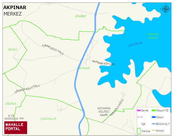
AKPINAR Village Digital Map | Updated Neighbourhood Map
AKPINAR Village – Population, Postal Code, Number of Workplaces
AKPINAR village MERKEZ district of ADIYAMAN province. UAVT (National Address Database Code) Village Code: 586. Postal Code: 2010. AKPINAR 7 streets and avenues, 3258 independent business licensed apartments, 846 residential licensed apartments, 225 households. 832 people live in this settlement. 428 male, 404 female. 60 and over is 140. The population rate of 60+ people is % 16 and the ratio of children under the age of 10 to the population is % 16
Leave a Comment