ALAPLIÖMERLI Village Digital Map | Geography and Natural Features
Zonguldak ilinde,
Alaplı ilçesinde, köyler içinde,
Yaşlılık oranı en yüksek bölgeler listesinde 2. Alaplıömerli sıralamada ikinci sırada yer almaktadır.
Alaplı ilçesinde, köyler içinde,
Yaşlılık oranı en yüksek bölgeler listesinde 2. Alaplıömerli sıralamada ikinci sırada yer almaktadır.
| Adi | ALAPLIÖMERLI Province Affiliated | ZONGULDAK District Affiliated | ALAPLI Postal code | 67852 Number of Streets | 2 Population Density km2-people | 210.00 Number of Apartments with business Licenses | 7 Number of Apartments with Residential Licenses | 256 Number of Households / Families | 110 Total Population | 298 Male Population | 152 Woman Population | 146 Income Per Person - Spendable TL-Month | 8.065 |
|---|
ALAPLIÖMERLI Village Map | Updated Neighbourhood Map
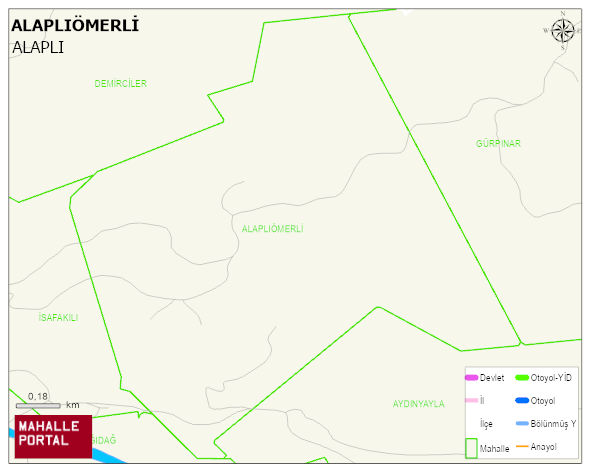
ALAPLIÖMERLI Village Digital Map | Geography and Natural Features
ALAPLIÖMERLI Village – Population, Postal Code, Number of Workplaces
ALAPLIÖMERLI village ALAPLI district of ZONGULDAK province. UAVT (National Address Database Code) Village Code: 34378. Postal Code: 67852. ALAPLIÖMERLI 2 streets and avenues, 7 independent business licensed apartments, 256 residential licensed apartments, 111 households. 314 people live in this settlement. 160 male, 154 female. 53 people have never married, 181 people are married, 16 people are divorced and 35 people have passed away. The number of people aged 60 and over is 114. The population rate of 60+ people is % 36
Leave a Comment