TOP 10: NÜFUS
Kayseri ilinde, mahalleler içinde,
Üst yaş grubunda lider listesinde 2. Amarat üst sıralarda yer aldı.
Kocasinan ilçesinde, mahalleler içinde,
Eğitim göstergeleri düşük seyrede listesinde 1. Amarat bölge içi sıralamada birinci konumdadır.
Üst yaş grubunda lider listesinde 1. Amarat yer alır.
| Adi | AMARAT Province Affiliated | KAYSERI District Affiliated | KOCASINAN Postal code | 38095 Number of Streets | 31 Population Density km2-people | 9.43 Number of Apartments with business Licenses | 108 Number of Apartments with Residential Licenses | 558 Number of Households / Families | 137 Total Population | 269 Male Population | 142 Woman Population | 127 Income Per Person - Spendable TL-Month | 5.335 |
|---|
AMARAT Neighbourhood Map | Satellite View and Local Boundaries
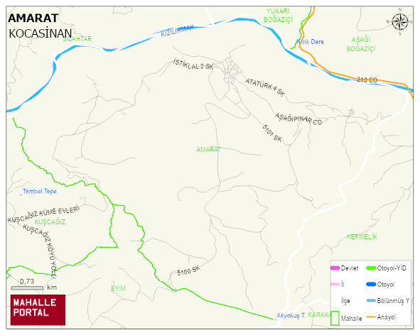
AMARAT Neighbourhood Digital Map | Detailed Villages and Neighbourhoods
AMARAT Neighbourhood – Population, Postal Code, Number of Workplaces
AMARAT neighborhood is located in KOCASINAN district of KAYSERI province. UAVT (National Address Database Code) Neighborhood Code: 180709. Postal Code: 38095. The population density is -per square kilometer- 10 people. AMARAT 31 streets and avenues, 105 independent business licensed apartments, 554 residential licensed apartments, 142 households. 291 people live in this settlement. 155 male, 136 female. 48 people have never married, 178 people are married, 18 people are divorced and 33 people have passed away. The number of people aged 60 and over is 164. The population rate of 60+ people is % 56 En yasli 600 mahalle ve köyden biridir. (Nüfusu 250den büyük 29000 köy ve mahalle içinde)