TOP 10: NÜFUS
Konya ilinde,
Karatay ilçesinde, mahalleler içinde,
En fazla nüfus barındıran listesinde 4. Araplar listede 4. sırada olmasıyla bilinir.
Hane yoğunluğu lider listesinde 3. Araplar 3. sırada kayıtlı olan önemli bir yerleşimdir.
En fazla konuta sahip listesinde 3. Araplar sıralamada üçüncü sırada yer almaktadır.
En eğitimli nüfusa sahip listesinde 4. Araplar dördüncü konumda bulunan mahalledir.
Rayiç bedeli zirvede listesinde 4. Araplar 4. sırada yer alan önemli bir mahalledir.
| Adi | ARAPLAR Province Affiliated | KONYA District Affiliated | KARATAY Postal code | 42000 Number of Streets | 89 Population Density km2-people | 19343.34 Number of Apartments with business Licenses | 620 Number of Apartments with Residential Licenses | 8637 Number of Households / Families | 6399 Total Population | 21420 Male Population | 10275 Woman Population | 11145 Income Per Person - Spendable TL-Month | 16.958 |
|---|
KEYKUBAT Neighbourhood Map | Detailed Villages and Neighbourhoods
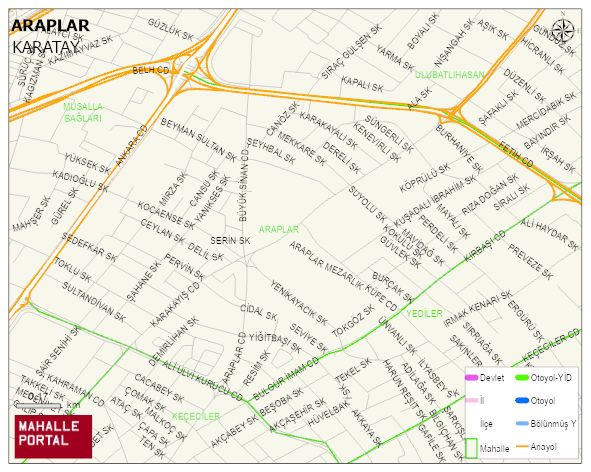
ARAPLAR Neighbourhood Digital Map | Interactive Neighbourhoods
ARAPLAR Neighbourhood – Population, Postal Code, Number of Workplaces
ARAPLAR neighborhood is located in KARATAY district of KONYA province. UAVT (National Address Database Code) Neighborhood Code: 116392. Postal Code: 42000. The population density is -per square kilometer- 19118 people. ARAPLAR 91 streets and avenues, 610 independent business licensed apartments, 8452 residential licensed apartments, 6276 households. 21166 people live in this settlement. 10164 male, 11002 female. 3833 people have never married, 10520 people are married, 639 people are divorced and 800 people have passed away. The number of people aged 60 and over is 2581. The population rate of 60+ people is % 12 and the ratio of children under the age of 10 to the population is % 17 KARATAY -in the district- 3. the most crowded neighbourhood.