TOP 10: NÜFUS
Samsun ilinde,
Asarcık ilçesinde, mahalleler içinde,
Arsa yatırımı sıralamasında 5. Armutlu kayıtlarda beşinci sırada konumlanmıştır.
Banka ATM'lerine ilişkin sıralamada 5. Armutlu kayıtlarda 5. sırada gözükmektedir.
Üst yaş grubunda lider listesinde 4. Armutlu dördüncü sırada konumlanan mahallelerden biridir.
| Adi | ARMUTLU Province Affiliated | SAMSUN District Affiliated | ASARCIK Postal code | 55860 Number of Streets | 1 Population Density km2-people | 86.57 Number of Apartments with business Licenses | 8 Number of Apartments with Residential Licenses | 365 Number of Households / Families | 219 Total Population | 831 Male Population | 419 Woman Population | 412 Income Per Person - Spendable TL-Month | 8.762 |
|---|
ARMUTLU Neighbourhood Map | Terrain and Topography
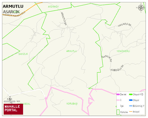
ARMUTLU Neighbourhood Digital Map | Geography and Natural Features
ARMUTLU Neighbourhood – Population, Postal Code, Number of Workplaces
ARMUTLU neighborhood is located in ASARCIK district of SAMSUN province. UAVT (National Address Database Code) Neighborhood Code: 186209. Postal Code: 55860. The population density is -per square kilometer- 87 people. ARMUTLU 1 streets and avenues, 7 independent business licensed apartments, 350 residential licensed apartments, 195 households. 843 people live in this settlement. 423 male, 420 female. 60 and over is 137. The population rate of 60+ people is % 16 and the ratio of children under the age of 10 to the population is % 14 ASARCIK -in the district- 8. the most crowded neighbourhood.