TOP 10: NÜFUS
Gaziantep ilinde, mahalleler içinde,
Bekârlık oranı sıralamasında 3. Arpalı yüksek skoruyla dikkat çekti.
İslahiye ilçesinde, mahalleler içinde,
Bekârlık oranı sıralamasında 1. Arpalı birinci konumda olmasıyla dikkat çeker.
Aile içindeki genç oranı sıralamasında 1. Arpalı yer alır.
| Adi | ARPALI Province Affiliated | GAZIANTEP District Affiliated | ISLAHIYE Postal code | 27800 Number of Streets | 2 Population Density km2-people | 137.25 Number of Apartments with business Licenses | 69 Number of Apartments with Residential Licenses | 131 Number of Households / Families | 104 Total Population | 818 Male Population | 356 Woman Population | 462 Income Per Person - Spendable TL-Month | 7.798 |
|---|
ARPALI Neighbourhood Map | Terrain and Topography
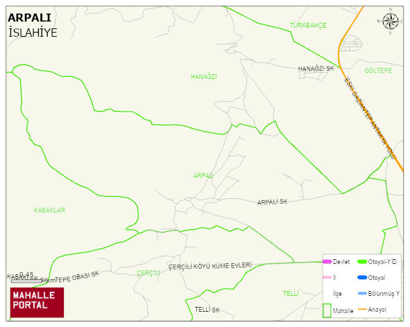
ARPALI Neighbourhood Digital Map | Mountains, Rivers and Elevation Details
ARPALI Neighbourhood – Population, Postal Code, Number of Workplaces
ARPALI neighborhood is located in ISLAHIYE district of GAZIANTEP province. UAVT (National Address Database Code) Neighborhood Code: 179529. Postal Code: 27800. The population density is -per square kilometer- 104 people. ARPALI 2 streets and avenues, 65 independent business licensed apartments, 120 residential licensed apartments, 101 households. 623 people live in this settlement. 261 male, 362 female. 60 and over is 75. The population rate of 60+ people is % 12 and the ratio of children under the age of 10 to the population is % 2