TOP 10: NÜFUS
Şanlıurfa ilinde,
Birecik ilçesinde, mahalleler içinde,
Bekar hane oranı yüksek listesinde 5. Aşağı Karkutlu sıralamada beşinci sırada yer almaktadır.
| Adi | ASAGI KARKUTLU Province Affiliated | SANLIURFA District Affiliated | BIRECIK Postal code | 63400 Number of Streets | 7 Population Density km2-people | 28.88 Number of Apartments with business Licenses | 4 Number of Apartments with Residential Licenses | 171 Number of Households / Families | 96 Total Population | 452 Male Population | 234 Woman Population | 218 Income Per Person - Spendable TL-Month | 3.548 |
|---|
ASAGI KARKUTLU Neighbourhood Map | Interactive Neighbourhoods
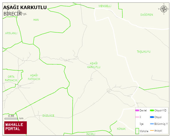
ASAGI KARKUTLU Neighbourhood Digital Map | Geography and Natural Features
ASAGI KARKUTLU Neighbourhood – Population, Postal Code, Number of Workplaces
ASAGI KARKUTLU neighborhood is located in BIRECIK district of SANLIURFA province. UAVT (National Address Database Code) Neighborhood Code: 173967. Postal Code: 63400. The population density is -per square kilometer- 28 people. ASAGI KARKUTLU 6 streets and avenues, 4 independent business licensed apartments, 175 residential licensed apartments, 93 households. 443 people live in this settlement. 227 male, 216 female. 60 and over is 21. The population rate of 60+ people is % 4 and the ratio of children under the age of 10 to the population is % 18
Leave a Comment