TOP 10: NÜFUS
Gaziantep ilinde,
Nurdağı ilçesinde, mahalleler içinde,
Eş kaybı yaşayan nüfusu en yüksek listesinde 4. Atmalı şehir içi istatistiklerde dördüncü konumdadır.
Yaşlı nüfusu en yüksek listesinde 1. Atmalı 1. sırada konumlanan mahalle olarak bilinir.
| Adi | ATMALI Province Affiliated | GAZIANTEP District Affiliated | NURDAGI Postal code | 27840 Number of Streets | 1 Population Density km2-people | 33.34 Number of Apartments with business Licenses | 26 Number of Apartments with Residential Licenses | 178 Number of Households / Families | 106 Total Population | 287 Male Population | 145 Woman Population | 142 Income Per Person - Spendable TL-Month | 7.131 |
|---|
ATMALI Neighbourhood Map | Updated Neighbourhood Map
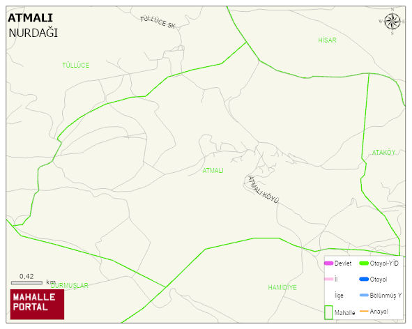
ATMALI Neighbourhood Digital Map | Terrain and Topography
ATMALI Neighbourhood – Population, Postal Code, Number of Workplaces
ATMALI neighborhood is located in NURDAGI district of GAZIANTEP province. UAVT (National Address Database Code) Neighborhood Code: 180021. Postal Code: 27840. The population density is -per square kilometer- 33 people. ATMALI 1 streets and avenues, 20 independent business licensed apartments, 133 residential licensed apartments, 110 households. 291 people live in this settlement. 143 male, 148 female. 60 and over is 93. The population rate of 60+ people is % 31
Leave a Comment