AYDINYAYLA Village Digital Map | Updated Neighbourhood Map
Zonguldak ilinde,
Alaplı ilçesinde, köyler içinde,
Yapı stoğu en yüksek listesinde 5. Aydınyayla beşinci konumda bulunan mahalledir.
Alaplı ilçesinde, köyler içinde,
Yapı stoğu en yüksek listesinde 5. Aydınyayla beşinci konumda bulunan mahalledir.
| Adi | AYDINYAYLA Province Affiliated | ZONGULDAK District Affiliated | ALAPLI Postal code | 67852 Number of Streets | 4 Population Density km2-people | 70.64 Number of Apartments with business Licenses | 14 Number of Apartments with Residential Licenses | 434 Number of Households / Families | 215 Total Population | 711 Male Population | 370 Woman Population | 341 Income Per Person - Spendable TL-Month | 7.639 |
|---|
AYDINYAYLA Village Map | All Neighbourhoods and Settlements
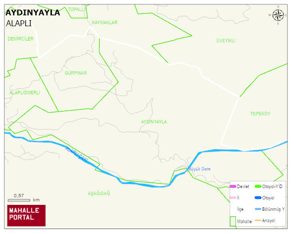
AYDINYAYLA Village Digital Map | Updated Neighbourhood Map
AYDINYAYLA Village – Population, Postal Code, Number of Workplaces
AYDINYAYLA village ALAPLI district of ZONGULDAK province. UAVT (National Address Database Code) Village Code: 34383. Postal Code: 67852. AYDINYAYLA 4 streets and avenues, 14 independent business licensed apartments, 434 residential licensed apartments, 208 households. 703 people live in this settlement. 366 male, 337 female. 121 people have never married, 389 people are married, 17 people are divorced and 57 people have passed away. The number of people aged 60 and over is 143. The population rate of 60+ people is % 20 and the ratio of children under the age of 10 to the population is % 12
Leave a Comment