TOP 10: NÜFUS
Kayseri ilinde,
Sarıoğlan ilçesinde, mahalleler içinde,
En yoğun nüfuslu listesinde 5. Bakarcak beşinci basamakta yer almasıyla bilinir.
Ekonomik gücü en yüksek listesinde 2. Bakarcak ikinci sırada yer almaktadır.
M² arsa değerinin en çok olduğu listesinde 4. Bakarcak kayıtlarda dördüncü basamakta gözükür.
Aile yapısının en genç olduğu listesinde 3. Bakarcak üçüncü konumda bulunan mahalledir.
| Adi | BAKARCAK Province Affiliated | KAYSERI District Affiliated | SARIOGLAN Postal code | 38820 Number of Streets | 62 Population Density km2-people | 27.18 Number of Apartments with business Licenses | 127 Number of Apartments with Residential Licenses | 637 Number of Households / Families | 353 Total Population | 1094 Male Population | 540 Woman Population | 554 Income Per Person - Spendable TL-Month | 11.993 |
|---|
BAKARCAK Neighbourhood Map | Updated Neighbourhood Map
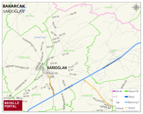
BAKARCAK Neighbourhood Digital Map | Detailed Villages and Neighbourhoods
BAKARCAK Neighbourhood – Population, Postal Code, Number of Workplaces
BAKARCAK neighborhood is located in SARIOGLAN district of KAYSERI province. UAVT (National Address Database Code) Neighborhood Code: 42284. Postal Code: 38820. The population density is -per square kilometer- 26 people. BAKARCAK 62 streets and avenues, 124 independent business licensed apartments, 632 residential licensed apartments, 342 households. 1079 people live in this settlement. 529 male, 550 female. 186 people have never married, 587 people are married, 31 people are divorced and 72 people have passed away. The number of people aged 60 and over is 220. The population rate of 60+ people is % 20 and the ratio of children under the age of 10 to the population is % 11 SARIOGLAN -in the district- 5. the most crowded neighbourhood.