BASAKPINAR Village Digital Map | Updated Neighbourhood Map
Kastamonu ilinde,
Devrekani ilçesinde, köyler içinde,
Ekonomik gücü en yüksek listesinde 4. Başakpınar 4. sırada kayıtlı, bölgenin önde gelen yerleşimlerinden biridir.
Ev–hane sayısı en çok olan listesinde 4. Başakpınar 4. sırada konumlanmış, öne çıkan bir yerleşimdir.
Eğitim durumunun zayıf olduğu listesinde 4. Başakpınar 4. sırada yer alan önemli bir mahalledir.
| Adi | BASAKPINAR Province Affiliated | KASTAMONU District Affiliated | DEVREKANI Postal code | 37702 Number of Streets | 3 Population Density km2-people | 8.25 Number of Apartments with business Licenses | 4 Number of Apartments with Residential Licenses | 113 Number of Households / Families | 85 Total Population | 216 Male Population | 118 Woman Population | 98 Income Per Person - Spendable TL-Month | 5.935 |
|---|
BASAKPINAR Village Map | Terrain and Topography
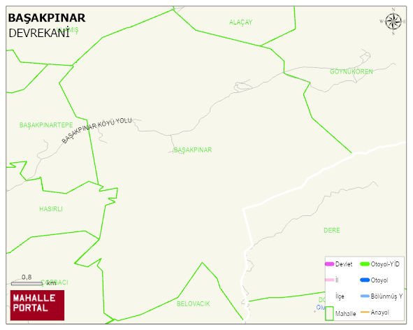
BASAKPINAR Village Digital Map | Updated Neighbourhood Map
BASAKPINAR Village – Population, Postal Code, Number of Workplaces
BASAKPINAR village DEVREKANI district of KASTAMONU province. UAVT (National Address Database Code) Village Code: 18524. Postal Code: 37702. BASAKPINAR 3 streets and avenues, 4 independent business licensed apartments, 113 residential licensed apartments, 97 households. 306 people live in this settlement. 166 male, 140 female. 60 and over is 103. The population rate of 60+ people is % 33 DEVREKANI -in the district- 8. the most crowded neighbourhood.
Leave a Comment