BASARAN Village Digital Map | Satellite View and Local Boundaries
Şırnak ilinde,
Beytüşşebap ilçesinde, köyler içinde,
En kalabalık listesinde 2. Başaran kayda geçen sıralamada ikinci konumdadır.
Aile sayısı bakımından zirvede listesinde 2. Başaran istatistiksel olarak ikinci sırada yer alır.
Yapı stoğu en yüksek listesinde 4. Başaran dördüncü sırada bulunmasıyla dikkat çeker.
Ticari hayatın en yoğun olduğu listesinde 2. Başaran 2. sırada olmasıyla dikkat çeker.
Arsa fiyatlarında lider listesinde 4. Başaran 4. sırada yer alan önemli bir mahalledir.
Eşi vefat edenlerin en yoğun olduğu listesinde 5. Başaran sıralamada beşinci sırada yer almaktadır.
| Adi | BASARAN Province Affiliated | SIRNAK District Affiliated | BEYTÜSSEBAP Postal code | 73802 Number of Streets | 1 Population Density km2-people | 43.25 Number of Apartments with business Licenses | 17 Number of Apartments with Residential Licenses | 258 Number of Households / Families | 215 Total Population | 727 Male Population | 371 Woman Population | 356 Income Per Person - Spendable TL-Month | 4.189 |
|---|
BASARAN Village Map | All Neighbourhoods and Settlements
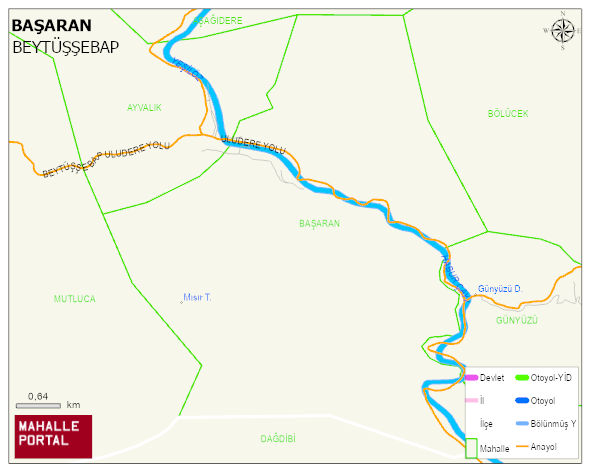
BASARAN Village Digital Map | Satellite View and Local Boundaries
BASARAN Village – Population, Postal Code, Number of Workplaces
BASARAN village BEYTÜSSEBAP district of SIRNAK province. UAVT (National Address Database Code) Village Code: 35793. Postal Code: 73802. BASARAN 1 streets and avenues, 17 independent business licensed apartments, 255 residential licensed apartments, 200 households. 682 people live in this settlement. 335 male, 347 female. 60 and over is 32. The population rate of 60+ people is % 4 and the ratio of children under the age of 10 to the population is % 14 BEYTÜSSEBAP -in the district- 7. the most crowded neighbourhood.
Leave a Comment