BAYRAMUSAGI Village Digital Map | Updated Neighbourhood Map
Kırşehir ilinde,
Mucur ilçesinde, köyler içinde,
Okuryazarlık oranı sınırlı listesinde 5. Bayramuşağı kayıtlarda ilk beş içinde, 5. sıradadır.
Mucur ilçesinde, köyler içinde,
Okuryazarlık oranı sınırlı listesinde 5. Bayramuşağı kayıtlarda ilk beş içinde, 5. sıradadır.
| Adi | BAYRAMUSAGI Province Affiliated | KIRSEHIR District Affiliated | MUCUR Postal code | 40502 Number of Streets | 1 Population Density km2-people | 4.14 Number of Apartments with business Licenses | 0 Number of Apartments with Residential Licenses | 76 Number of Households / Families | 48 Total Population | 92 Male Population | 47 Woman Population | 45 Income Per Person - Spendable TL-Month | 5.024 |
|---|
BAYRAMUSAGI Village Map | Mountains, Rivers and Elevation Details
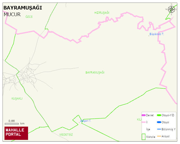
BAYRAMUSAGI Village Digital Map | Updated Neighbourhood Map
BAYRAMUSAGI Village – Population, Postal Code, Number of Workplaces
BAYRAMUSAGI village MUCUR district of KIRSEHIR province. UAVT (National Address Database Code) Village Code: 19932. Postal Code: 40502. BAYRAMUSAGI 1 streets and avenues, 76 residential licensed apartments, 50 households. 99 people live in this settlement. 51 male, 48 female.
Leave a Comment