BOYALI Village Digital Map | Satellite View and Local Boundaries
Sivas ilinde,
Koyulhisar ilçesinde, köyler içinde,
Gelir düzeyi bakımından şampiyo listesinde 4. Boyalı 4. sırada konumlanmış, öne çıkan bir yerleşimdir.
Mesken sayısı bakımından öne çıkan listesinde 2. Boyalı sıralamada ikinci sırada yer almaktadır.
Servet sahibi kişilerin yoğun olduğu listesinde 2. Boyalı sıralamada ikinci sırada yer almaktadır.
Dul oranı en belirgin olan listesinde 1. Boyalı kayıtlarda en yüksek sırada yer almaktadır.
Üst yaş grubunda lider listesinde 4. Boyalı 4. sırada yer alan önemli bir mahalledir.
| Adi | BOYALI Province Affiliated | SIVAS District Affiliated | KOYULHISAR Postal code | 58662 Number of Streets | 5 Population Density km2-people | 17.16 Number of Apartments with business Licenses | 2 Number of Apartments with Residential Licenses | 653 Number of Households / Families | 140 Total Population | 342 Male Population | 160 Woman Population | 182 Income Per Person - Spendable TL-Month | 6.058 |
|---|
BOYALI Village Map | Satellite View and Local Boundaries
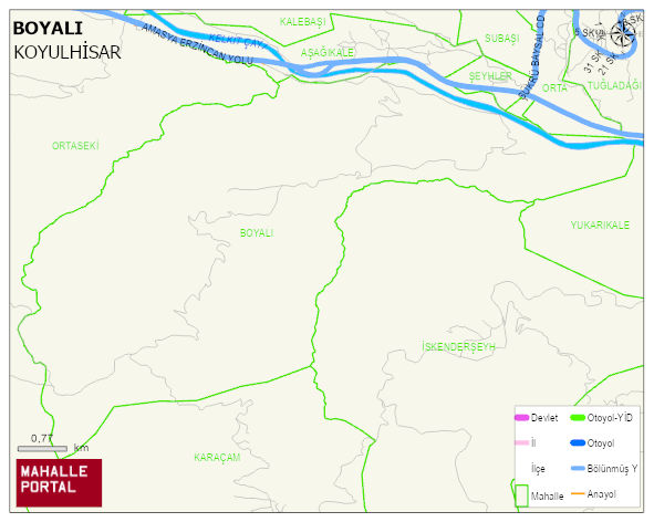
BOYALI Village Digital Map | Satellite View and Local Boundaries
BOYALI Village – Population, Postal Code, Number of Workplaces
BOYALI village KOYULHISAR district of SIVAS province. UAVT (National Address Database Code) Village Code: 29279. Postal Code: 58662. BOYALI 5 streets and avenues, 2 independent business licensed apartments, 419 residential licensed apartments, 158 households. 476 people live in this settlement. 230 male, 246 female. 60 and over is 222. The population rate of 60+ people is % 46 KOYULHISAR -in the district- 4. the most crowded neighbourhood.
Leave a Comment