ÇALTILI Village Digital Map | Updated Neighbourhood Map
Kütahya ilinde,
Tavşanlı ilçesinde, köyler içinde,
İleri yaş grubunda zirvede listesinde 4. Çaltılı 4. sırada konumlanmış, öne çıkan bir yerleşimdir.
Yerleşim ağı en geniş olan listesinde 5. Çaltılı istatistiksel olarak beşinci sıradadır.
Tavşanlı ilçesinde, köyler içinde,
İleri yaş grubunda zirvede listesinde 4. Çaltılı 4. sırada konumlanmış, öne çıkan bir yerleşimdir.
Yerleşim ağı en geniş olan listesinde 5. Çaltılı istatistiksel olarak beşinci sıradadır.
| Adi | ÇALTILI Province Affiliated | KÜTAHYA District Affiliated | TAVSANLI Postal code | 43302 Number of Streets | 4 Population Density km2-people | 19.37 Number of Apartments with business Licenses | 13 Number of Apartments with Residential Licenses | 342 Number of Households / Families | 121 Total Population | 274 Male Population | 132 Woman Population | 142 Income Per Person - Spendable TL-Month | 5.972 |
|---|
ÇALTILI Village Map | Detailed Villages and Neighbourhoods
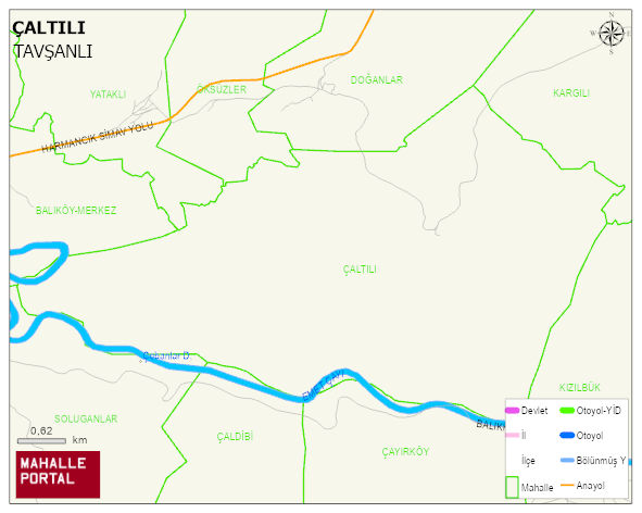
ÇALTILI Village Digital Map | Updated Neighbourhood Map
ÇALTILI Village – Population, Postal Code, Number of Workplaces
ÇALTILI village TAVSANLI district of KÜTAHYA province. UAVT (National Address Database Code) Village Code: 21523. Postal Code: 43302. ÇALTILI 4 streets and avenues, 13 independent business licensed apartments, 342 residential licensed apartments, 128 households. 295 people live in this settlement. 141 male, 154 female. 60 and over is 123. The population rate of 60+ people is % 41
Leave a Comment