TOP 10: NÜFUS
Ankara ilinde,
Nallıhan ilçesinde, mahalleler içinde,
Yaşça büyük nüfus oranı yüksek listesinde 2. Çamalan şehir sıralamasında 2. sıradadır.
| Adi | ÇAMALAN Province Affiliated | ANKARA District Affiliated | NALLIHAN Postal code | 06920 Number of Streets | 1 Population Density km2-people | 8.73 Number of Apartments with business Licenses | 20 Number of Apartments with Residential Licenses | 471 Number of Households / Families | 180 Total Population | 336 Male Population | 159 Woman Population | 177 Income Per Person - Spendable TL-Month | 7.604 |
|---|
ÇAMALAN Neighbourhood Map | All Neighbourhoods and Settlements
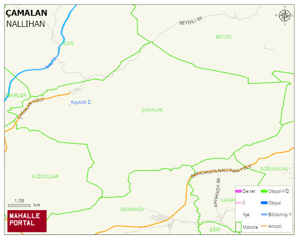
ÇAMALAN Neighbourhood Digital Map | Mountains, Rivers and Elevation Details
ÇAMALAN Neighbourhood – Population, Postal Code, Number of Workplaces
ÇAMALAN neighborhood is located in NALLIHAN district of ANKARA province. UAVT (National Address Database Code) Neighborhood Code: 178935. Postal Code: 6920. The population density is -per square kilometer- 9 people. ÇAMALAN 1 streets and avenues, 20 independent business licensed apartments, 467 residential licensed apartments, 187 households. 353 people live in this settlement. 168 male, 185 female. 60 and over is 208. The population rate of 60+ people is % 58 En yasli 600 mahalle ve köyden biridir. (Nüfusu 250den büyük 29000 köy ve mahalle içinde)
Leave a Comment