ÇARDAS Village Digital Map | Updated Neighbourhood Map
Zonguldak ilinde,
Kozlu ilçesinde, köyler içinde,
Yükseköğretim düzeyi lider listesinde 2. Çardaş sıralamada ikinci sırada yer almaktadır.
Finans erişimi en geniş olan listesinde 4. Çardaş sıralamada dördüncü sıradadır.
Yalnız yaşayanların en fazla bulunduğu listesinde 5. Çardaş kayıtlarda ilk beş içinde, 5. sıradadır.
Yerleşim ağı en geniş olan listesinde 5. Çardaş beşinci konumda bulunan mahalledir.
| Adi | ÇARDAS Province Affiliated | ZONGULDAK District Affiliated | KOZLU Postal code | 67602 Number of Streets | 4 Population Density km2-people | 51.24 Number of Apartments with business Licenses | 3 Number of Apartments with Residential Licenses | 268 Number of Households / Families | 139 Total Population | 382 Male Population | 200 Woman Population | 182 Income Per Person - Spendable TL-Month | 6.765 |
|---|
ÇARDAS Village Map | Geography and Natural Features
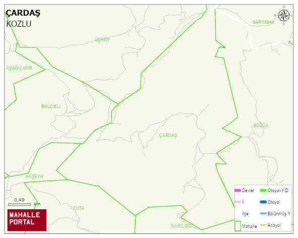
ÇARDAS Village Digital Map | Updated Neighbourhood Map
ÇARDAS Village – Population, Postal Code, Number of Workplaces
ÇARDAS village KOZLU district of ZONGULDAK province. UAVT (National Address Database Code) Village Code: 49273. Postal Code: 67602. ÇARDAS 4 streets and avenues, 3 independent business licensed apartments, 266 residential licensed apartments, 142 households. 432 people live in this settlement. 227 male, 205 female. 89 people have never married, 258 people are married, 16 people are divorced and 27 people have passed away. The number of people aged 60 and over is 116. The population rate of 60+ people is % 26
Leave a Comment