İlçedeki Nüfusu En Yüksek Yerleşimler
ÇARSAMBA, SAMSUN
| Name | ÇARSAMBA |
|---|---|
| Province Affiliated | SAMSUN |
| City Plate code | 55 |
| Population Density km2-people | 177,24 |
| Number of Apartments with business Licenses | 9.813 |
| Number of Apartments with Residential Licenses | 68.165 |
| Number of Households / Families | 41.627 |
| Average Household Size | 3,33 |
| Total Population | 141.850 |
| Foreigner Population | 578 |
| Area km2 | 800,32 |
ÇARSAMBA, SAMSUN Digital Map | Updated District and Neighbourhood Map
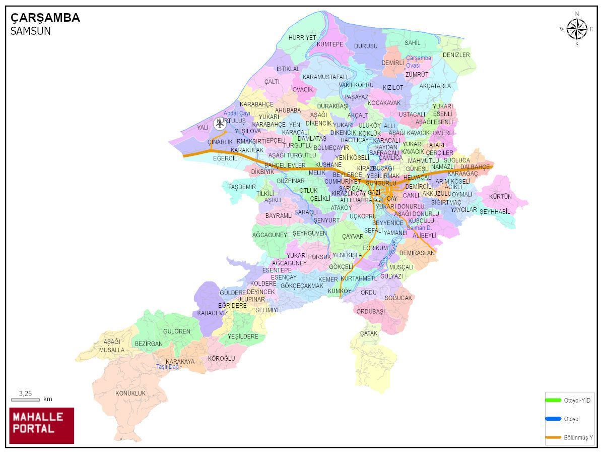
Çarşamba ilçesinde 143 mahalle bulunmaktadır.
| ACIKLI | AĞCAGÜNEY | AHUBABA | AKÇALTI |
| AKÇATARLA | AKKUZULU | ALİ FUAT BAŞGİL | ALİBEYLİ |
| ALLI | ARIM KÖSELİ | AŞAĞI DİKENCİK | AŞAĞI DONURLU |
| AŞAĞI ESENLİ | AŞAĞI KAVACIK | AŞAĞI MUSALLA | AŞAĞI TURGUTLU |
Tümünü Göster (143)
ÇARSAMBA, SAMSUN Digital Map | Updated District and Neighbourhood Map
Highest economic power
Center of economic activities
Hosting the most university graduates
Highest land value
Areas with highest aging ratio
Highest ATM density
Leader in household density
Having the most housing units
Low in education rankings
Leader in independent living
Where most widowed people live
Most streets
Leader in number of wealthy people
Highest young-to-child ratio
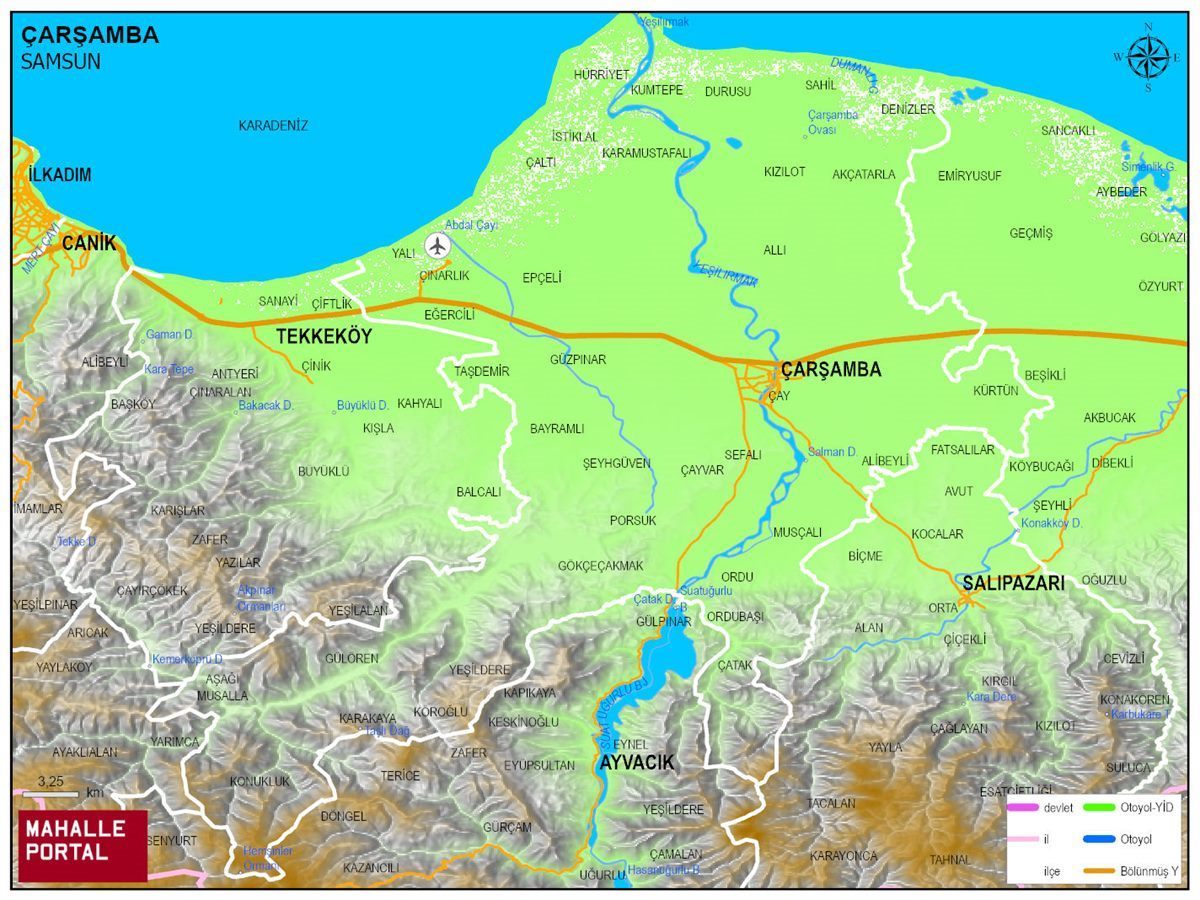
ÇARSAMBA Physical Map | District Terrain and Topography
ÇARSAMBA Neighbourhood Map | All Neighbourhoods and Settlements
ÇARSAMBA Population and Family Structure
| District Center Population | 141.199 |
|---|---|
| Town and Village Population | 0 |
| Male Population | 70.245 |
| Female Population | 70.954 |
| Average Age | 37 |
| Average Age of Males | 37 |
| Average Age of Females | 38 |
| Number of Household Members | 40.696 |
| Average Household Size | 3 |
| Number of Single Person Households | 6.694 |
| Number of Nuclear Family Households | 23.884 |
| Number of Large Family Households | 9.439 |
| Number of Non-Nuclear Family Households | 679 |
ÇARSAMBA Artificial Intelligence Comments for
ÇARSAMBA is a district of SAMSUN province. The population is 141199, the number of streets is 1848, the number of apartments with housing licenses is 66326 and the number of independent businesses with business licenses is 9679. The average age is calculated as 37, 37 for men and 38 for women. 27794 people have never married, 74392 people are married, 8331 people of (wife - husband) have passed away, and 3484 people are divorced. The average household size of the district is 3, Tek kisinin yasadigi hane sayisi 6694, and the number of nuclear family households is 23884.
Leave a Comment
NEIGHBORHOODS
CUMHURİYET
HELVACALI
ARIM KÖSELİ
AŞAĞI DİKENCİK
AŞAĞI DONURLU
AŞAĞI ESENLİ
AŞAĞI KAVACIK
AŞAĞI MUSALLA
ATAKÖY
BAFRACALI
BEYLERCE
BEYYENİCE
BEZİRGAN
BOYACILI
BÖLMEÇAYIR
CANLI
ÇATAK
ÇAYVAR
ÇERÇİLER
DALBAHÇE
DEMİRASLAN
DEMİRCİLİ
DEMİRLİ
DENİZLER
DEYİNCEK
DURAKBAŞI
DURUSU
EĞRİDERE
EĞRİKUM
ESENÇAY
GÖKÇEÇAKMAK
GÖKÇELİ
GÜLDERE
GÜLÖREN
GÜLYAZI
GÜNEŞLİ
HACILIÇAY
KARAAĞAÇ
KARACALI
KARAKAYA
KARAMUSTAFALI
KAYDAN
KESTANEPINAR
KIZILOT
KİRAZBUCAĞI
KOCAKAVAK
KOLDERE
KONUKLUK
KÖKLÜK
ÇAMLICA
KUMKÖY
KUMTEPE
KURTAHMETLİ
KUŞÇULU
KUŞHANE
KÜRTÜN
MAHMUTLU
MELİK
YALI
EĞERCİLİ
KURTULUŞ
BAHÇELİEVLER
GÜZPINAR
İSTİKLAL
YUKARI AĞCAGÜNEY
MUSÇALI
NAMAZLI
ORDUBAŞI
ORDU
OVACIK
OYMALI
ÖMERLİ
PAŞAYAZI
SEFALI
SAHİL
SIĞIRTMAÇ
SOĞUCAK
SUĞLUCA
ŞEYHHABİL
TATARLI
ULUKÖY
USTACALI
UZUNLU
VAKIFKÖPRÜ
YAYCILAR
YAMANLI
YENİ KIŞLA
YENİ KÖSELİ
YUKARI DİKENCİK
YUKARI DONURLU
YUKARI ESENLİ
YUKARI KAVACIK
ZÜMRÜT
AKÇALTI
KEMER
KÖROĞLU
ULUPINAR
SELİMİYE
AHUBABA
AŞAĞI TURGUTLU
AŞIKLI
BAYRAMLI
ÇALTI
ÇELİKLİ
DAMLATAŞ
EPÇELİ
IRMAKSIRTI
KARABAHÇE
KARAKULAK
OTLUK
PORSUK
SARAÇLI
ŞENYURT
ŞEYHGÜVEN
TAŞDEMİR
TİLKİLİ
TURGUTLU
YENİ KARACALI
YEŞİLOVA
YUKARI KARABAHÇE
ESENTEPE
KABACEVİZ
ALİBEYLİ
YEŞİLDERE
HÜRRİYET
DİKBIYIK
AĞCAGÜNEY
ÇINARLIK
ACIKLI
AKÇATARLA
AKKUZULU
ALLI
ALİ FUAT BAŞGİL
ÇAY
GAZİ
HASBAHÇE
KİRAZLIKÇAY
ORTA
SARICALI
SUNGURLU
UMUT
ÜÇKÖPRÜ
YEŞİLIRMAK