ÇATAKKIRI Village Digital Map | Updated Neighbourhood Map
Giresun ilinde,
Görele ilçesinde, köyler içinde,
En yoğun nüfuslu listesinde 5. Çatakkırı sıralamada beşinci sırada yer almaktadır.
M² arsa değerinin en çok olduğu listesinde 4. Çatakkırı sıralamada dördüncü sıradadır.
Bekâr oranı zirvede listesinde 4. Çatakkırı 4. sırada konumlanmış, öne çıkan bir yerleşimdir.
Aile yapısının en genç olduğu listesinde 2. Çatakkırı istatistiksel olarak ikinci sırada yer alır.
| Adi | ÇATAKKIRI Province Affiliated | GIRESUN District Affiliated | GÖRELE Postal code | 28802 Number of Streets | 1 Population Density km2-people | 23.01 Number of Apartments with business Licenses | 10 Number of Apartments with Residential Licenses | 534 Number of Households / Families | 126 Total Population | 339 Male Population | 174 Woman Population | 165 Income Per Person - Spendable TL-Month | 5.817 |
|---|
ÇATAKKIRI Village Map | Mountains, Rivers and Elevation Details
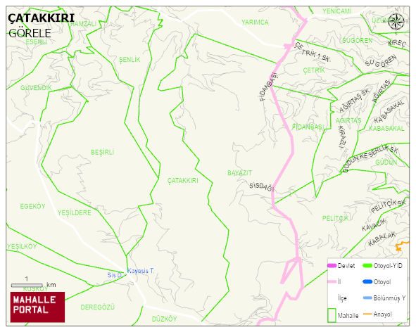
ÇATAKKIRI Village Digital Map | Updated Neighbourhood Map
ÇATAKKIRI Village – Population, Postal Code, Number of Workplaces
ÇATAKKIRI village GÖRELE district of GIRESUN province. UAVT (National Address Database Code) Village Code: 14634. Postal Code: 28802. ÇATAKKIRI 1 streets and avenues, 10 independent business licensed apartments, 533 residential licensed apartments, 129 households. 388 people live in this settlement. 196 male, 192 female. 60 and over is 128. The population rate of 60+ people is % 32
Leave a Comment