ÇATALSU Village Digital Map | All Neighbourhoods and Settlements
Aksaray ilinde,
Gülağaç ilçesinde, köyler içinde,
Kişi başı kazancı lider listesinde 4. Çatalsu sıralamada dördüncü sıradadır.
Yükseköğretim düzeyi lider listesinde 1. Çatalsu istatistiklere göre en üst sıradadır.
Finans erişimi en geniş olan listesinde 5. Çatalsu sıralamada beşinci sırada yer almaktadır.
Eşi vefat edenlerin en yoğun olduğu listesinde 1. Çatalsu istatistiklere göre en üst sıradadır.
Genç–çocuk oranı zirvede listesinde 1. Çatalsu istatistiklere göre en üst sıradadır.
İleri yaş grubunda zirvede listesinde 5. Çatalsu sıralamada beşinci sırada yer almaktadır.
| Adi | ÇATALSU Province Affiliated | AKSARAY District Affiliated | GÜLAGAÇ Postal code | 68902 Number of Streets | 14 Population Density km2-people | 9.65 Number of Apartments with business Licenses | 5 Number of Apartments with Residential Licenses | 108 Number of Households / Families | 70 Total Population | 277 Male Population | 142 Woman Population | 135 Income Per Person - Spendable TL-Month | 6.011 |
|---|
ÇATALSU Village Map | Terrain and Topography
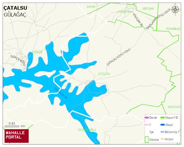
ÇATALSU Village Digital Map | All Neighbourhoods and Settlements
ÇATALSU Village – Population, Postal Code, Number of Workplaces
ÇATALSU village GÜLAGAÇ district of AKSARAY province. UAVT (National Address Database Code) Village Code: 34853. Postal Code: 68902. ÇATALSU 14 streets and avenues, 5 independent business licensed apartments, 108 residential licensed apartments, 70 households. 298 people live in this settlement. 156 male, 142 female. 60 and over is 67. The population rate of 60+ people is % 22 and the ratio of children under the age of 10 to the population is % 12
Leave a Comment