TOP 10: NÜFUS
Ordu ilinde,
Kumru ilçesinde, mahalleler içinde,
Mesken adedi lider listesinde 4. Çatılı sıralamada dördüncülük pozisyonundadır.
İş potansiyeli en yüksek listesinde 4. Çatılı dördüncü sırada bulunmasıyla dikkat çeker.
Single yaşam oranı yüksek listesinde 2. Çatılı istatistiklere göre 2. sıradadır.
| Adi | ÇATILI Province Affiliated | ORDU District Affiliated | KUMRU Postal code | 52800 Number of Streets | 22 Population Density km2-people | 6.11 Number of Apartments with business Licenses | 53 Number of Apartments with Residential Licenses | 917 Number of Households / Families | 123 Total Population | 327 Male Population | 167 Woman Population | 160 Income Per Person - Spendable TL-Month | 5.689 |
|---|
ÇATILI Neighbourhood Map | Mountains, Rivers and Elevation Details
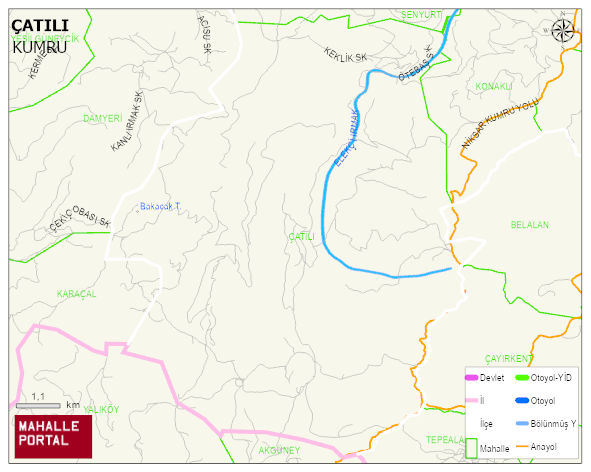
ÇATILI Neighbourhood Digital Map | Updated Neighbourhood Map
ÇATILI Neighbourhood – Population, Postal Code, Number of Workplaces
ÇATILI neighborhood is located in KUMRU district of ORDU province. UAVT (National Address Database Code) Neighborhood Code: 151575. Postal Code: 52800. The population density is -per square kilometer- 6 people. ÇATILI 22 streets and avenues, 49 independent business licensed apartments, 891 residential licensed apartments, 123 households. 348 people live in this settlement. 173 male, 175 female. 60 and over is 120. The population rate of 60+ people is % 34