ÇUKURALIÇ Village Digital Map | Satellite View and Local Boundaries
Çorum ilinde, köyler içinde,
Arsa değerinin en yüksek olduğu listesinde 5. Çukuralıç üst sıralarda kendine yer buldu.
Kargı ilçesinde, köyler içinde, En çok kişinin yaşadığı2. Çukuralıç 2. sırada konumlanan mahallelerden biridir.
Arsa değerinin en yüksek olduğu listesinde 1. Çukuralıç istatistiklere göre en üst sıradadır.
En fazla ATM bulunan listesinde 3. Çukuralıç sıralamada üçüncü sırada yer almaktadır.
Çocuk nüfusu en yüksek listesinde 1. Çukuralıç 1. sırada, bölgenin en önde gelen yerleşimidir.
| Adi | ÇUKURALIÇ Province Affiliated | ÇORUM District Affiliated | KARGI Postal code | 19902 Number of Streets | 2 Population Density km2-people | 18.83 Number of Apartments with business Licenses | 7 Number of Apartments with Residential Licenses | 337 Number of Households / Families | 176 Total Population | 486 Male Population | 246 Woman Population | 240 Income Per Person - Spendable TL-Month | 6.511 |
|---|
ÇUKURALIÇ Village Map | Detailed Villages and Neighbourhoods
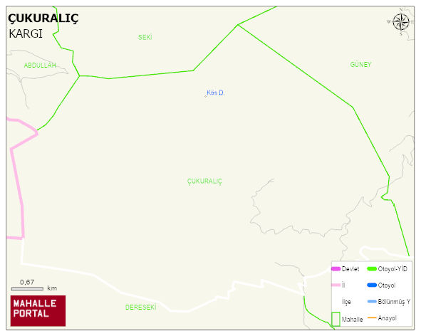
ÇUKURALIÇ Village Digital Map | Satellite View and Local Boundaries
ÇUKURALIÇ Village – Population, Postal Code, Number of Workplaces
ÇUKURALUÇ village KARGI district of ÇORUM province. UAVT (National Address Database Code) Village Code: 9491. Postal Code: 19902. ÇUKURALUÇ 2 streets and avenues, 7 independent business licensed apartments, 336 residential licensed apartments, 176 households. 488 people live in this settlement. 251 male, 237 female. 60 and over is 119. The population rate of 60+ people is % 24 and the ratio of children under the age of 10 to the population is % 11 KARGI -in the district- 7. the most crowded neighbourhood.
Leave a Comment