TOP 10: NÜFUS
Erzincan ilinde, mahalleler içinde,
En fazla nüfus barındıran listesinde 2. Cumhuriyet üst sıralarda yer aldı.
Hane yoğunluğu lider listesinde 2. Cumhuriyet üst sıralarda yer aldı.
En fazla konuta sahip listesinde 2. Cumhuriyet üst sıralarda yer aldı.
Merkez ilçesinde, mahalleler içinde,
En fazla nüfus barındıran listesinde 2. Cumhuriyet ikinci sırada yer almaktadır.
Hane yoğunluğu lider listesinde 2. Cumhuriyet istatistik listelerinde ikinci konumdadır.
En fazla konuta sahip listesinde 2. Cumhuriyet kayıtlarda ikinci sırada yer bulmuştur.
| Adi | CUMHURIYET Province Affiliated | ERZINCAN District Affiliated | MERKEZ Postal code | 24002 Number of Streets | 48 Population Density km2-people | 7733.09 Number of Apartments with business Licenses | 159 Number of Apartments with Residential Licenses | 3974 Number of Households / Families | 2520 Total Population | 7974 Male Population | 3550 Woman Population | 4424 Income Per Person - Spendable TL-Month | 20.786 |
|---|
CUMHURIYET Neighbourhood Map | Updated Neighbourhood Map
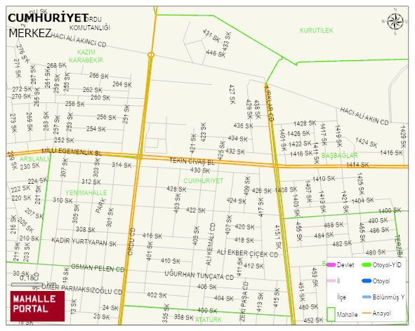
CUMHURIYET Neighbourhood Digital Map | Terrain and Topography
CUMHURIYET Neighbourhood – Population, Postal Code, Number of Workplaces
CUMHURIYET neighborhood is located in MERKEZ district of ERZINCAN province. UAVT (National Address Database Code) Neighborhood Code: 21472. Postal Code: 24002. The population density is -per square kilometer- 7509 people. CUMHURIYET 47 streets and avenues, 156 independent business licensed apartments, 3872 residential licensed apartments, 2491 households. 7740 people live in this settlement. 3430 male, 4310 female. 2228 people have never married, 3376 people are married, 341 people are divorced and 283 people have passed away. The number of people aged 60 and over is 923. The population rate of 60+ people is % 11 and the ratio of children under the age of 10 to the population is % 12 MERKEZ -in the district- 2. the most crowded neighbourhood.