DAYILI Village Digital Map | Updated Neighbourhood Map
Yozgat ilinde,
Merkez ilçesinde, köyler içinde,
Değerli arsa bölgeleri arasında listesinde 3. Dayılı üçüncü konumda bulunan mahalledir.
Doğurganlık etkisi yüksek listesinde 4. Dayılı sıralamada dördüncü sıradadır.
Mahalle içi yol/sokak sayısı zirvede listesinde 5. Dayılı 5. sırada yer alarak üst beş içinde bulunmaktadır.
| Adi | DAYILI Province Affiliated | YOZGAT District Affiliated | MERKEZ Postal code | 66010 Number of Streets | 2 Population Density km2-people | 7.78 Number of Apartments with business Licenses | 19 Number of Apartments with Residential Licenses | 149 Number of Households / Families | 91 Total Population | 260 Male Population | 143 Woman Population | 117 Income Per Person - Spendable TL-Month | 5.604 |
|---|
DAYILI Village Map | Mountains, Rivers and Elevation Details
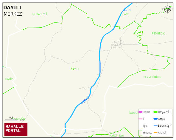
DAYILI Village Digital Map | Updated Neighbourhood Map
DAYILI Village – Population, Postal Code, Number of Workplaces
DAYILI village MERKEZ district of YOZGAT province. UAVT (National Address Database Code) Village Code: 33748. Postal Code: 66010. DAYILI 2 streets and avenues, 27 independent business licensed apartments, 150 residential licensed apartments, 94 households. 259 people live in this settlement. 143 male, 116 female. 60 and over is 91. The population rate of 60+ people is % 35
Leave a Comment