| Adi | DODURGA Province Affiliated | ANKARA District Affiliated | ÇANKAYA Postal code | 06810 Number of Streets | 62 Population Density km2-people | 914.36 Number of Apartments with business Licenses | 251 Number of Apartments with Residential Licenses | 6529 Number of Households / Families | 4531 Total Population | 12734 Male Population | 6060 Woman Population | 6674 Income Per Person - Spendable TL-Month | 44.870 |
|---|
DODURGA Neighbourhood Map | All Neighbourhoods and Settlements
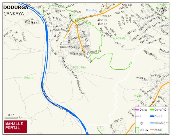
DODURGA Neighbourhood Digital Map | Satellite View and Local Boundaries
DODURGA Neighbourhood – Population, Postal Code, Number of Workplaces
DODURGA neighborhood is located in ÇANKAYA district of ANKARA province. UAVT (National Address Database Code) Neighborhood Code: 1903. Postal Code: 6810. The population density is -per square kilometer- 868 people. DODURGA 56 streets and avenues, 249 independent business licensed apartments, 6284 residential licensed apartments, 4295 households. 12090 people live in this settlement. 5746 male, 6344 female. 2324 people have never married, 6544 people are married, 751 people are divorced and 406 people have passed away. The number of people aged 60 and over is 2145. The population rate of 60+ people is % 17 and the ratio of children under the age of 10 to the population is % 10
Leave a Comment