EGRIAMBAR Village Digital Map | Boundaries of Villages
Giresun ilinde,
Dereli ilçesinde, köyler içinde,
Nüfusu en fazla listesinde 3. Eğrianbar sıralamada üçüncü sırada yer almaktadır.
En geniş aile yerleşimi listesinde 2. Eğrianbar sıralamada ikinci sırada yer almaktadır.
Servet sahibi kişilerin yoğun olduğu listesinde 1. Eğrianbar istatistiklere göre en üst sıradadır.
Bekârlık oranı bakımından ilk sırada listesinde 3. Eğrianbar şehir içi sıralamada 3. sıradadır.
Sokak ağı güçlü olan listesinde 5. Eğrianbar beşinci basamakta yer almasıyla bilinir.
| Adi | EGRIAMBAR Province Affiliated | GIRESUN District Affiliated | DERELI Postal code | 28952 Number of Streets | 12 Population Density km2-people | 34.35 Number of Apartments with business Licenses | 10 Number of Apartments with Residential Licenses | 902 Number of Households / Families | 301 Total Population | 623 Male Population | 339 Woman Population | 284 Income Per Person - Spendable TL-Month | 5.750 |
|---|
EGRIANBAR Village Map | Interactive Neighbourhoods
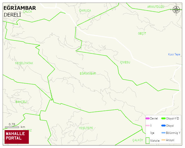
EGRIAMBAR Village Digital Map | Boundaries of Villages
EGRIAMBAR Village – Population, Postal Code, Number of Workplaces
EGRIANBAR village DERELI district of GIRESUN province. UAVT (National Address Database Code) Village Code: 14539. Postal Code: 28952. EGRIANBAR 12 streets and avenues, 10 independent business licensed apartments, 896 residential licensed apartments, 332 households. 761 people live in this settlement. 408 male, 353 female. 167 people have never married, 417 people are married, 33 people are divorced and 92 people have passed away. The number of people aged 60 and over is 308. The population rate of 60+ people is % 40 and the ratio of children under the age of 10 to the population is % 2 DERELI -in the district- 6. the most crowded neighbourhood.
Leave a Comment