TOP 10: NÜFUS
Zonguldak ilinde,
Ereğli ilçesinde, mahalleler içinde,
Zengin sayısı bakımından lider listesinde 4. Elma Tepe istatistik listelerinde 4. sıradadır.
| Adi | ELMA TEPE Province Affiliated | ZONGULDAK District Affiliated | EREGLI Postal code | 67300 Number of Streets | 15 Population Density km2-people | 4392.98 Number of Apartments with business Licenses | 377 Number of Apartments with Residential Licenses | 2704 Number of Households / Families | 1594 Total Population | 4468 Male Population | 2285 Woman Population | 2183 Income Per Person - Spendable TL-Month | 16.012 |
|---|
ELMA TEPE Neighbourhood Map | Updated Neighbourhood Map
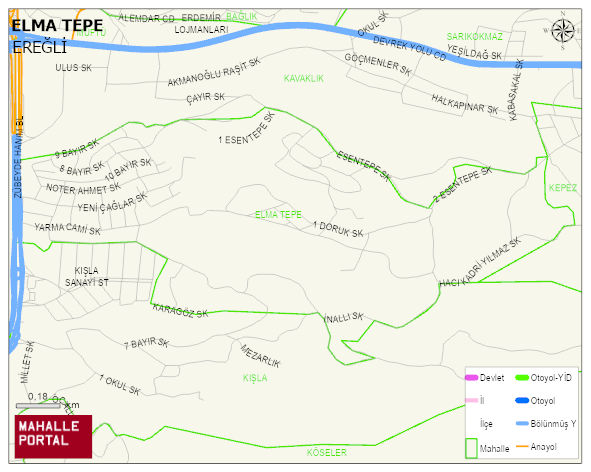
ELMA TEPE Neighbourhood Digital Map | Boundaries of Villages
ELMA TEPE Neighbourhood – Population, Postal Code, Number of Workplaces
ELMA TEPE neighborhood is located in EREGLI district of ZONGULDAK province. UAVT (National Address Database Code) Neighborhood Code: 89854. Postal Code: 67300. The population density is -per square kilometer- 4453 people. ELMA TEPE 14 streets and avenues, 375 independent business licensed apartments, 2637 residential licensed apartments, 1580 households. 4534 people live in this settlement. 2308 male, 2226 female. 968 people have never married, 2280 people are married, 197 people are divorced and 226 people have passed away. The number of people aged 60 and over is 645. The population rate of 60+ people is % 14 and the ratio of children under the age of 10 to the population is % 12 EREGLI -in the district- 9. the most crowded neighbourhood.