ELMALI Village Digital Map | Boundaries of Villages
Niğde ilinde,
Merkez ilçesinde, köyler içinde,
İleri yaş grubunda zirvede listesinde 2. Elmalı sıralamada ikinci sırada yer almaktadır.
Yerleşim ağı en geniş olan listesinde 5. Elmalı istatistiksel sıralamada beşinci konumdadır.
Merkez ilçesinde, köyler içinde,
İleri yaş grubunda zirvede listesinde 2. Elmalı sıralamada ikinci sırada yer almaktadır.
Yerleşim ağı en geniş olan listesinde 5. Elmalı istatistiksel sıralamada beşinci konumdadır.
| Adi | ELMALI Province Affiliated | NIGDE District Affiliated | MERKEZ Postal code | 51300 Number of Streets | 86 Population Density km2-people | 13.72 Number of Apartments with business Licenses | 37 Number of Apartments with Residential Licenses | 752 Number of Households / Families | 326 Total Population | 718 Male Population | 353 Woman Population | 365 Income Per Person - Spendable TL-Month | 7.291 |
|---|
ELMALI Village Map | Terrain and Topography
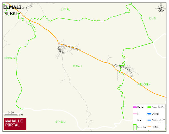
ELMALI Village Digital Map | Boundaries of Villages
ELMALI Village – Population, Postal Code, Number of Workplaces
ELMALI village MERKEZ district of NIGDE province. UAVT (National Address Database Code) Village Code: 25203. Postal Code: 51300. ELMALI 87 streets and avenues, 37 independent business licensed apartments, 749 residential licensed apartments, 333 households. 753 people live in this settlement. 370 male, 383 female. 135 people have never married, 405 people are married, 24 people are divorced and 113 people have passed away. The number of people aged 60 and over is 296. The population rate of 60+ people is % 39 and the ratio of children under the age of 10 to the population is % 6
Leave a Comment