GERIS Village Digital Map | Mountains, Rivers and Elevation Details
Zonguldak ilinde, köyler içinde,
Arsa değeri bakımından ilk sırada listesinde 5. Geriş ilk beşi tamamladı.
Sokak bakımından en kalabalık listesinde 3. Geriş üst sıralarda istikrarlı bir performans sergiliyor.
Çaycuma ilçesinde, köyler içinde,
Ekonomik faaliyetlerin merkezi listesinde 2. Geriş istatistik sıralamasında ikinci sırada yer almaktadır.
Arsa değeri bakımından ilk sırada listesinde 4. Geriş istatistiklere göre dördüncü basamakta yer alır.
Lüks yaşam oranı en yüksek listesinde 2. Geriş listede ikinci basamakta yer alır.
Sokak bakımından en kalabalık listesinde 2. Geriş sıralamada ikinci sırada yer almaktadır.
| Adi | GERIS Province Affiliated | ZONGULDAK District Affiliated | ÇAYCUMA Postal code | 67660 Number of Streets | 21 Population Density km2-people | 272.76 Number of Apartments with business Licenses | 91 Number of Apartments with Residential Licenses | 469 Number of Households / Families | 216 Total Population | 650 Male Population | 338 Woman Population | 312 Income Per Person - Spendable TL-Month | 5.544 |
|---|
GERIS Village Map | Geography and Natural Features
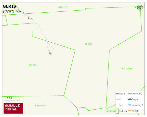
GERIS Village Digital Map | Mountains, Rivers and Elevation Details
GERIS Village – Population, Postal Code, Number of Workplaces
GERIS village ÇAYCUMA district of ZONGULDAK province. UAVT (National Address Database Code) Village Code: 34437. Postal Code: 67660. GERIS 21 streets and avenues, 95 independent business licensed apartments, 467 residential licensed apartments, 215 households. 641 people live in this settlement. 333 male, 308 female. 125 people have never married, 374 people are married, 22 people are divorced and 51 people have passed away. The number of people aged 60 and over is 206. The population rate of 60+ people is % 32 and the ratio of children under the age of 10 to the population is % 4
Leave a Comment