GÖLARDI Village Digital Map | Updated Neighbourhood Map
Elazığ ilinde, köyler içinde,
Ekonomik refahın merkezi listesinde 2. Gölardı üst sıralarda yer aldı.
Merkez ilçesinde, köyler içinde,
Ekonomik refahın merkezi listesinde 1. Gölardı istatistiklere göre en üst sıradadır.
Öğretim düzeyi gelişmeye açık listesinde 2. Gölardı listede ikinci basamakta yer alır.
Eşini kaybetmiş bireylerin merkezi listesinde 5. Gölardı sıralamada beşinci sırada yer almaktadır.
Yaşlılık oranı en yüksek bölgeler listesinde 4. Gölardı 4. sırada yer alarak üst sıralara yakın bir konumdadır.
Mahalle içi yol/sokak sayısı zirvede listesinde 4. Gölardı kayıtlarda dördüncü basamakta gözükmektedir.
| Adi | GÖLARDI Province Affiliated | ELAZIG District Affiliated | MERKEZ Postal code | 23250 Number of Streets | 9 Population Density km2-people | 11.48 Number of Apartments with business Licenses | 9 Number of Apartments with Residential Licenses | 345 Number of Households / Families | 83 Total Population | 250 Male Population | 123 Woman Population | 127 Income Per Person - Spendable TL-Month | 9.642 |
|---|
GÖLARDI Village Map | Terrain and Topography
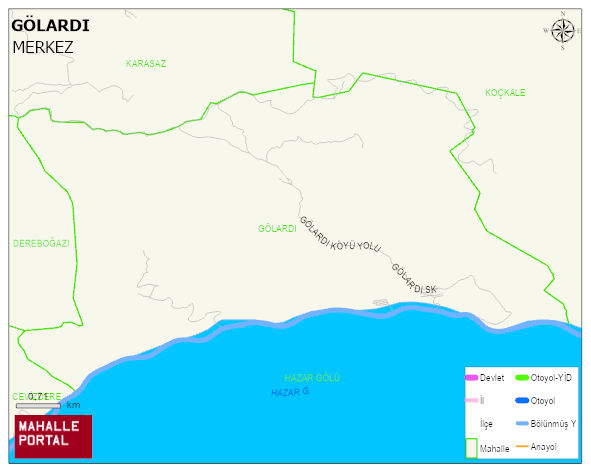
GÖLARDI Village Digital Map | Updated Neighbourhood Map
GÖLARDI Village – Population, Postal Code, Number of Workplaces
GÖLARDI village MERKEZ district of ELAZIG province. UAVT (National Address Database Code) Village Code: 11438. Postal Code: 23250. GÖLARDI 9 streets and avenues, 9 independent business licensed apartments, 296 residential licensed apartments, 95 households. 512 people live in this settlement. 262 male, 250 female. 60 and over is 121. The population rate of 60+ people is % 23 and the ratio of children under the age of 10 to the population is % 8
Leave a Comment