GÖLDALI Village Digital Map | Updated Neighbourhood Map
Kars ilinde,
Arpaçay ilçesinde, köyler içinde,
Yalnız kalan yetişkin oranı yüksek listesinde 2. Göldalı şehir sıralamasında 2. sıradadır.
Sokak dokusu zengin bölgeler listesinde 5. Göldalı beşinci konumda bulunan mahalledir.
Arpaçay ilçesinde, köyler içinde,
Yalnız kalan yetişkin oranı yüksek listesinde 2. Göldalı şehir sıralamasında 2. sıradadır.
Sokak dokusu zengin bölgeler listesinde 5. Göldalı beşinci konumda bulunan mahalledir.
| Adi | GÖLDALI Province Affiliated | KARS District Affiliated | ARPAÇAY Postal code | 36732 Number of Streets | 1 Population Density km2-people | 7.84 Number of Apartments with business Licenses | 6 Number of Apartments with Residential Licenses | 112 Number of Households / Families | 60 Total Population | 151 Male Population | 78 Woman Population | 73 Income Per Person - Spendable TL-Month | 2.441 |
|---|
GÖLDALI Village Map | Boundaries of Villages
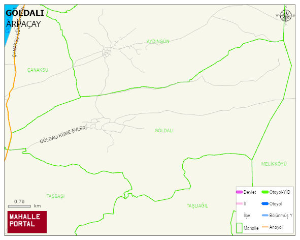
GÖLDALI Village Digital Map | Updated Neighbourhood Map
GÖLDALI Village – Population, Postal Code, Number of Workplaces
GÖLDALI village ARPAÇAY district of KARS province. UAVT (National Address Database Code) Village Code: 17644. Postal Code: 36732. GÖLDALI 1 streets and avenues, 6 independent business licensed apartments, 110 residential licensed apartments, 61 households. 158 people live in this settlement. 84 male, 74 female.
Leave a Comment