TOP 10: NÜFUS
İstanbul ilinde,
Beylikdüzü ilçesinde, mahalleler içinde,
Eğitim seviyesinde alt sıralarda listesinde 1. Gürpınar bölge sıralamasında birinci sıradadır.
Bekar hane oranı yüksek listesinde 3. Gürpınar şehir içi sıralamada 3. sıradadır.
Dul hane sayısı en fazla listesinde 3. Gürpınar üçüncü konumda bulunan mahalledir.
Sokak bakımından en kalabalık listesinde 4. Gürpınar sıralamada dördüncülük pozisyonundadır.
| Adi | GÜRPINAR Province Affiliated | ISTANBUL District Affiliated | BEYLIKDÜZÜ Postal code | 34528 Number of Streets | 142 Population Density km2-people | 8200.25 Number of Apartments with business Licenses | 848 Number of Apartments with Residential Licenses | 9573 Number of Households / Families | 6192 Total Population | 20753 Male Population | 10220 Woman Population | 10533 Income Per Person - Spendable TL-Month | 23.606 |
|---|
GÜRPINAR Neighbourhood Map | Terrain and Topography
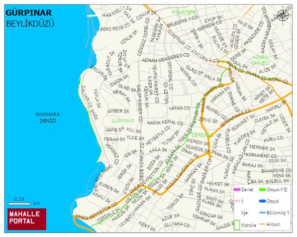
GÜRPINAR Neighbourhood Digital Map | Updated Neighbourhood Map
GÜRPINAR Neighbourhood – Population, Postal Code, Number of Workplaces
GÜRPINAR neighborhood is located in BEYLIKDÜZÜ district of ISTANBUL province. UAVT (National Address Database Code) Neighborhood Code: 40867. Postal Code: 34528. The population density is -per square kilometer- 8108 people. GÜRPINAR 143 streets and avenues, 829 independent business licensed apartments, 9268 residential licensed apartments, 6048 households. 20533 people live in this settlement. 10163 male, 10370 female. 4905 people have never married, 9749 people are married, 923 people are divorced and 616 people have passed away. The number of people aged 60 and over is 2274. The population rate of 60+ people is % 11 and the ratio of children under the age of 10 to the population is % 13 BEYLIKDÜZÜ -in the district- 8. the most crowded neighbourhood.