TOP 10: NÜFUS
Kırşehir ilinde, mahalleler içinde,
Bağımsız yaşayan nüfusta lider listesinde 3. Hacıpınar zirveye doğru tırmanışta.
Doğurganlık etkisi yüksek listesinde 3. Hacıpınar ilk üçteki yerini perçinledi.
Kaman ilçesinde, mahalleler içinde,
ATM ağı en yaygı listesinde 4. Hacıpınar yer alır.
Bağımsız yaşayan nüfusta lider listesinde 1. Hacıpınar istatistiklere göre 1. sırada yer almaktadır.
Doğurganlık etkisi yüksek listesinde 1. Hacıpınar 1. sırada yer alan, öne çıkan mahalledir.
| Adi | HACIPINAR Province Affiliated | KIRSEHIR District Affiliated | KAMAN Postal code | 40300 Number of Streets | 74 Population Density km2-people | 74.99 Number of Apartments with business Licenses | 68 Number of Apartments with Residential Licenses | 744 Number of Households / Families | 388 Total Population | 1538 Male Population | 789 Woman Population | 749 Income Per Person - Spendable TL-Month | 11.117 |
|---|
HACIPINAR Neighbourhood Map | Detailed Villages and Neighbourhoods
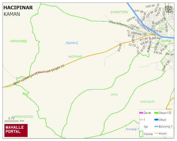
HACIPINAR Neighbourhood Digital Map | Updated Neighbourhood Map
HACIPINAR Neighbourhood – Population, Postal Code, Number of Workplaces
HACIPINAR neighborhood is located in KAMAN district of KIRSEHIR province. UAVT (National Address Database Code) Neighborhood Code: 50088. Postal Code: 40300. The population density is -per square kilometer- 75 people. HACIPINAR 74 streets and avenues, 64 independent business licensed apartments, 732 residential licensed apartments, 395 households. 1541 people live in this settlement. 790 male, 751 female. 589 people have never married, 613 people are married, 51 people are divorced and 104 people have passed away. The number of people aged 60 and over is 319. The population rate of 60+ people is % 20 and the ratio of children under the age of 10 to the population is % 6 KAMAN -in the district- 6. the most crowded neighbourhood.