HARMANAGILI Village Digital Map | Boundaries of Villages
Amasya ilinde,
Suluova ilçesinde, köyler içinde,
İş potansiyeli en yüksek listesinde 3. Harmanağılı sıralamada üçüncü sırada yer almaktadır.
Refah seviyesi yüksek nüfus yoğunluğu listesinde 5. Harmanağılı istatistiksel olarak beşinci sıradadır.
Sokak çeşitliliği lider listesinde 5. Harmanağılı 5. sırada kayıtlı ve dikkat çeken bir yerleşimdir.
| Adi | HARMANAGILI Province Affiliated | AMASYA District Affiliated | SULUOVA Postal code | 05502 Number of Streets | 3 Population Density km2-people | 34.42 Number of Apartments with business Licenses | 53 Number of Apartments with Residential Licenses | 133 Number of Households / Families | 48 Total Population | 183 Male Population | 94 Woman Population | 89 Income Per Person - Spendable TL-Month | 6.887 |
|---|
HARMANAGILI Village Map | Geography and Natural Features
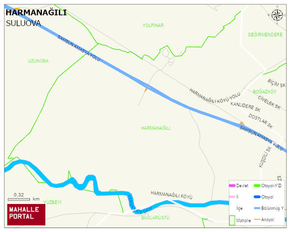
HARMANAGILI Village Digital Map | Boundaries of Villages
HARMANAGILI Village – Population, Postal Code, Number of Workplaces
HARMANAGILI village SULUOVA district of AMASYA province. UAVT (National Address Database Code) Village Code: 2345. Postal Code: 5502. HARMANAGILI 3 streets and avenues, 53 independent business licensed apartments, 130 residential licensed apartments, 44 households. 173 people live in this settlement. 90 male, 83 female.
Leave a Comment