HARMANALTI Village Digital Map | Terrain and Topography
Kırşehir ilinde,
Boztepe ilçesinde, köyler içinde, En çok kişinin yaşadığı4. Harmanaltı istatistik listelerinde 4. sıradadır.
En fazla hanenin yaşadığı listesinde 3. Harmanaltı sıralamada üçüncü sırada yer almaktadır.
Konut sayısının zirvede olduğu listesinde 4. Harmanaltı dördüncü sırada bulunmasıyla dikkat çeker.
İşyeri sayısında zirvede listesinde 2. Harmanaltı sıralamada ikinci sırada yer alır.
| Adi | HARMANALTI Province Affiliated | KIRSEHIR District Affiliated | BOZTEPE Postal code | 40060 Number of Streets | 1 Population Density km2-people | 6.89 Number of Apartments with business Licenses | 45 Number of Apartments with Residential Licenses | 140 Number of Households / Families | 82 Total Population | 247 Male Population | 132 Woman Population | 115 Income Per Person - Spendable TL-Month | 5.135 |
|---|
HARMANALTI Village Map | Boundaries of Villages
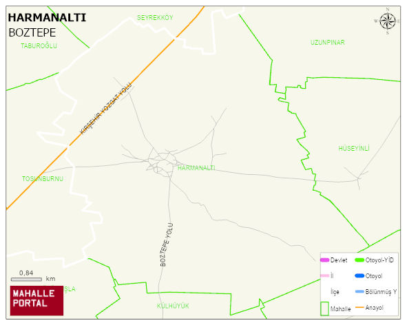
HARMANALTI Village Digital Map | Terrain and Topography
HARMANALTI Village – Population, Postal Code, Number of Workplaces
HARMANALTI village BOZTEPE district of KIRSEHIR province. UAVT (National Address Database Code) Village Code: 19781. Postal Code: 40060. HARMANALTI 1 streets and avenues, 32 independent business licensed apartments, 122 residential licensed apartments, 79 households. 258 people live in this settlement. 144 male, 114 female. 60 and over is 76. The population rate of 60+ people is % 29 BOZTEPE -in the district- 7. the most crowded neighbourhood.
Leave a Comment