TOP 10: NÜFUS
İzmir ilinde,
Çiğli ilçesinde, mahalleler içinde,
Öğretim düzeyi gelişmeye açık listesinde 3. Harmandalı Gazi Mustafa Kemal Atatürk üçüncü konumda bulunan mahalledir.
Doğurganlık etkisi yüksek listesinde 2. Harmandalı Gazi Mustafa Kemal Atatürk istatistik listelerinde ikinci konumdadır.
| Adi | HARMANDALI GAZI MUSTAFA KEMAL ATATÜRK Province Affiliated | IZMIR District Affiliated | ÇIGLI Postal code | 35650 Number of Streets | 62 Population Density km2-people | 705.30 Number of Apartments with business Licenses | 196 Number of Apartments with Residential Licenses | 2001 Number of Households / Families | 962 Total Population | 2819 Male Population | 1416 Woman Population | 1403 Income Per Person - Spendable TL-Month | 17.919 |
|---|
HARMANDALI GAZI MUSTAFA KEMAL ATATÜRK Neighbourhood Map | Satellite View and Local Boundaries
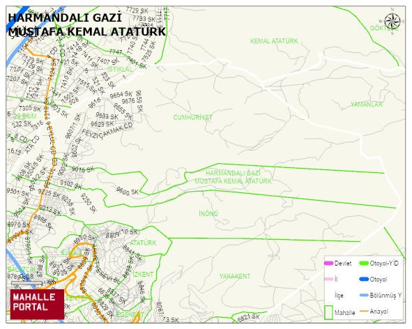
HARMANDALI GAZI MUSTAFA KEMAL ATATÜRK Neighbourhood Digital Map | Geography and Natural Features
HARMANDALI GAZI MUSTAFA KEMAL ATATÜRK Neighbourhood – Population, Postal Code, Number of Workplace
HARMANDALI GAZI MUSTAFA KEMAL ATATÜRK neighborhood is located in ÇIGLI district of IZMIR province. UAVT (National Address Database Code) Neighborhood Code: 41538. Postal Code: 35650. The population density is -per square kilometer- 716 people. HARMANDALI GAZI MUSTAFA KEMAL ATATÜRK 62 streets and avenues, 186 independent business licensed apartments, 1708 residential licensed apartments, 958 households. 2863 people live in this settlement. 1413 male, 1450 female. 525 people have never married, 1430 people are married, 168 people are divorced and 128 people have passed away. The number of people aged 60 and over is 394. The population rate of 60+ people is % 13 and the ratio of children under the age of 10 to the population is % 14