TOP 10: NÜFUS
Konya ilinde,
Taşkent ilçesinde, mahalleler içinde,
Kalabalığıyla öne çıkan listesinde 2. Hıra 2. sırada, bölgenin önde gelen yerleşimlerinden biridir.
En varlıklı nüfusun yaşadığı listesinde 1. Hıra yer alır.
Hane nüfusunun en kalabalık olduğu listesinde 4. Hıra yer alır.
Mesken adedi lider listesinde 4. Hıra yer alır.
İş potansiyeli en yüksek listesinde 4. Hıra istatistik listelerinde dördüncü sırada bulunur.
Üniversite mezunlarının en yoğun olduğu listesinde 2. Hıra ikinci konumda bulunan mahalledir.
Gayrimenkul rayici en yüksek listesinde 2. Hıra yer alır.
Çocuk sayısı bakımından lider listesinde 2. Hıra ikinci sırada yer almaktadır.
| Adi | HIRA Province Affiliated | KONYA District Affiliated | TASKENT Postal code | 42960 Number of Streets | 12 Population Density km2-people | 168.91 Number of Apartments with business Licenses | 52 Number of Apartments with Residential Licenses | 450 Number of Households / Families | 220 Total Population | 588 Male Population | 294 Woman Population | 294 Income Per Person - Spendable TL-Month | 11.329 |
|---|
HIRA Neighbourhood Map | Detailed Villages and Neighbourhoods
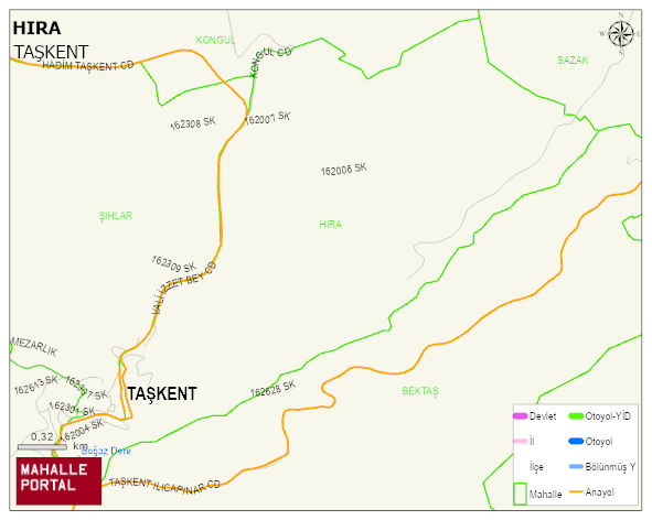
HIRA Neighbourhood Digital Map | Satellite View and Local Boundaries
HIRA Neighbourhood – Population, Postal Code, Number of Workplaces
HIRA neighborhood is located in TASKENT district of KONYA province. UAVT (National Address Database Code) Neighborhood Code: 51355. Postal Code: 42960. The population density is -per square kilometer- 177 people. HIRA 12 streets and avenues, 51 independent business licensed apartments, 450 residential licensed apartments, 223 households. 620 people live in this settlement. 310 male, 310 female. 60 and over is 91. The population rate of 60+ people is % 14 and the ratio of children under the age of 10 to the population is % 17 TASKENT -in the district- 5. the most crowded neighbourhood.