TOP 10: NÜFUS
Antalya ilinde, mahalleler içinde,
Aile büyüklüğü sıralamasında 3. Hurma ortalamanın oldukça üzerinde gelir sağladı.
Konyaaltı ilçesinde, mahalleler içinde,
Nüfus sıralamasında 1. Hurma yer alır.
Aile büyüklüğü sıralamasında 1. Hurma yer alır.
Mesken sayısı sıralamasında 1. Hurma yer alır.
Bekârlık oranı sıralamasında 2. Hurma ikinci konumda bulunan mahalledir.
Üst yaş grubunda lider listesinde 3. Hurma kayıtlarda üçüncü sırada gözükür.
Sokak ağına ilişkin sıralamada 3. Hurma sıralamada üçüncü sırada yer almaktadır.
| Adi | HURMA Province Affiliated | ANTALYA District Affiliated | KONYAALTI Postal code | 07130 Number of Streets | 90 Population Density km2-people | 7468.50 Number of Apartments with business Licenses | 587 Number of Apartments with Residential Licenses | 16898 Number of Households / Families | 10975 Total Population | 27498 Male Population | 13532 Woman Population | 13966 Income Per Person - Spendable TL-Month | 39.867 |
|---|
HURMA Neighbourhood Map | Satellite View and Local Boundaries
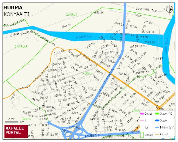
HURMA Neighbourhood Digital Map | Boundaries of Villages
HURMA Neighbourhood – Population, Postal Code, Number of Workplaces
HURMA neighborhood is located in KONYAALTI district of ANTALYA province. UAVT (National Address Database Code) Neighborhood Code: 2339. Postal Code: 7130. The population density is -per square kilometer- 7566 people. HURMA 90 streets and avenues, 392 independent business licensed apartments, 16768 residential licensed apartments, 11047 households. 27880 people live in this settlement. 13593 male, 14287 female. 6321 people have never married, 12591 people are married, 2754 people are divorced and 804 people have passed away. The number of people aged 60 and over is 3588. The population rate of 60+ people is % 12 and the ratio of children under the age of 10 to the population is % 12 KONYAALTI -in the district- 1. the most crowded neighbourhood.