HURMALIK Village Digital Map | Updated Neighbourhood Map
Rize ilinde, köyler içinde,
Eğitim seviyesi en düşük listesinde 3. Hurmalık güçlü rakipleri arasında öne çıktı.
Kalkandere ilçesinde, köyler içinde,
En yüksek gelir seviyesine sahip listesinde 2. Hurmalık sıralamada ikinci sırada yer alır.
Eğitim seviyesi en düşük listesinde 1. Hurmalık sıralamada birinci olarak kayda geçmiştir.
Üniversite mezunu oranı en yüksek listesinde 4. Hurmalık 4. sırada kayıtlı, bölgenin önde gelen yerleşimlerinden biridir.
Varlıklı nüfusu en yüksek listesinde 4. Hurmalık sıralamada dördüncülük pozisyonundadır.
Yaşlı nüfusu en yüksek listesinde 3. Hurmalık istatistiksel olarak üçüncü sıradadır.
Sokak sayısı en yüksek listesinde 5. Hurmalık istatistiksel olarak beşinci sıradadır.
| Adi | HURMALIK Province Affiliated | RIZE District Affiliated | KALKANDERE Postal code | 53540 Number of Streets | 1 Population Density km2-people | 102.31 Number of Apartments with business Licenses | 10 Number of Apartments with Residential Licenses | 359 Number of Households / Families | 135 Total Population | 355 Male Population | 200 Woman Population | 155 Income Per Person - Spendable TL-Month | 8.538 |
|---|
HURMALIK Village Map | Interactive Neighbourhoods
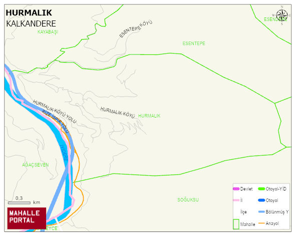
HURMALIK Village Digital Map | Updated Neighbourhood Map
HURMALIK Village – Population, Postal Code, Number of Workplaces
HURMALIK village KALKANDERE district of RIZE province. UAVT (National Address Database Code) Village Code: 26221. Postal Code: 53540. HURMALIK 1 streets and avenues, 10 independent business licensed apartments, 355 residential licensed apartments, 154 households. 676 people live in this settlement. 383 male, 293 female. 60 and over is 186. The population rate of 60+ people is % 27 and the ratio of children under the age of 10 to the population is % 6 KALKANDERE -in the district- 5. the most crowded neighbourhood.
Leave a Comment