KAHYALI Village Digital Map | Updated Neighbourhood Map
Çankırı ilinde,
Kızılırmak ilçesinde, köyler içinde,
Hane nüfusunun en kalabalık olduğu listesinde 5. Kahyalı 5. sırada yer alarak üst beş içinde bulunmaktadır.
Mesken adedi lider listesinde 4. Kahyalı sıralamada dördüncü sıradadır.
Üniversite mezunlarının en yoğun olduğu listesinde 1. Kahyalı istatistiklere göre en üst sıradadır.
| Adi | KAHYALI Province Affiliated | ÇANKIRI District Affiliated | KIZILIRMAK Postal code | 18282 Number of Streets | 1 Population Density km2-people | 9.21 Number of Apartments with business Licenses | 0 Number of Apartments with Residential Licenses | 173 Number of Households / Families | 111 Total Population | 249 Male Population | 124 Woman Population | 125 Income Per Person - Spendable TL-Month | 6.956 |
|---|
KAHYALI Village Map | Geography and Natural Features
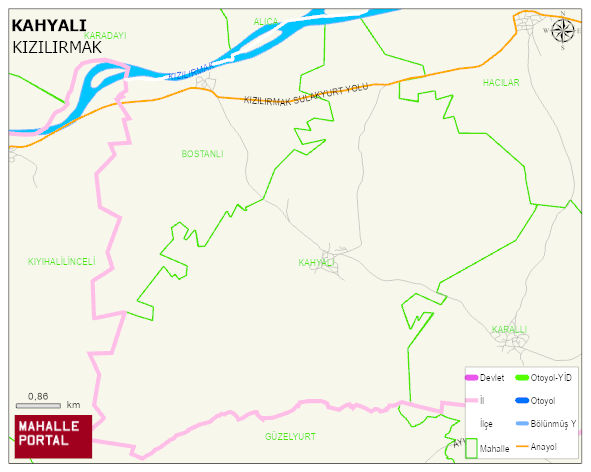
KAHYALI Village Digital Map | Updated Neighbourhood Map
KAHYALI Village – Population, Postal Code, Number of Workplaces
KAHYALI village KIZILIRMAK district of ÇANKIRI province. UAVT (National Address Database Code) Village Code: 8855. Postal Code: 18282. KAHYALI 1 streets and avenues, 173 residential licensed apartments, 115 households. 309 people live in this settlement. 164 male, 145 female. 60 and over is 139. The population rate of 60+ people is % 44 KIZILIRMAK -in the district- 7. the most crowded neighbourhood.
Leave a Comment