TOP 10: NÜFUS
Adana ilinde,
Yumurtalık ilçesinde, mahalleler içinde,
Ticari yoğunluk sıralamasında 5. Kaldırım 5. sırada kayıtlı ve dikkat çeken bir yerleşimdir.
Eğitim göstergeleri düşük seyrede listesinde 2. Kaldırım ikinci sırada yer almaktadır.
Dul oranı sıralamasında 3. Kaldırım sıralamada üçüncü sırada yer almaktadır.
Sokak ağına ilişkin sıralamada 3. Kaldırım sıralamada üçüncü basamakta yer alır.
| Adi | KALDIRIM Province Affiliated | ADANA District Affiliated | YUMURTALIK Postal code | 01682 Number of Streets | 68 Population Density km2-people | 10.56 Number of Apartments with business Licenses | 176 Number of Apartments with Residential Licenses | 576 Number of Households / Families | 401 Total Population | 1112 Male Population | 591 Woman Population | 521 Income Per Person - Spendable TL-Month | 8.711 |
|---|
KALDIRIM Neighbourhood Map | Updated Neighbourhood Map
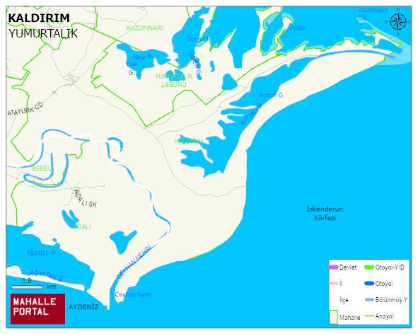
KALDIRIM Neighbourhood Digital Map | Terrain and Topography
KALDIRIM Neighbourhood – Population, Postal Code, Number of Workplaces
KALDIRIM neighborhood is located in YUMURTALIK district of ADANA province. UAVT (National Address Database Code) Neighborhood Code: 177719. Postal Code: 1682. The population density is -per square kilometer- 10 people. KALDIRIM 68 streets and avenues, 173 independent business licensed apartments, 568 residential licensed apartments, 406 households. 1150 people live in this settlement. 600 male, 550 female. 240 people have never married, 634 people are married, 34 people are divorced and 75 people have passed away. The number of people aged 60 and over is 322. The population rate of 60+ people is % 28 and the ratio of children under the age of 10 to the population is % 8 YUMURTALIK -in the district- 6. the most crowded neighbourhood.