KALEOGLU Village Digital Map | Satellite View and Local Boundaries
Zonguldak ilinde,
Merkez ilçesinde, köyler içinde,
En çok kazanç sağlaya listesinde 3. Kaleoğlu şehir içi sıralamada 3. sıradadır.
Hane adedi bakımından ilk sırada listesinde 3. Kaleoğlu 3. sırada kayıtlı ve öne çıkan bir alandır.
En çok yerleşim birimi barındıran listesinde 2. Kaleoğlu ikinci sırada olup üst sıralarda yer alır.
Emekli nüfusun merkezi listesinde 2. Kaleoğlu ikinci konumda bulunan mahalledir.
Sokak bakımından en kalabalık listesinde 1. Kaleoğlu bölge sıralamasında birinci sıradadır.
| Adi | KALEOGLU Province Affiliated | ZONGULDAK District Affiliated | MERKEZ Postal code | 67980 Number of Streets | 11 Population Density km2-people | 46.30 Number of Apartments with business Licenses | 10 Number of Apartments with Residential Licenses | 463 Number of Households / Families | 220 Total Population | 483 Male Population | 238 Woman Population | 245 Income Per Person - Spendable TL-Month | 6.988 |
|---|
KALEOGLU Village Map | Satellite View and Local Boundaries
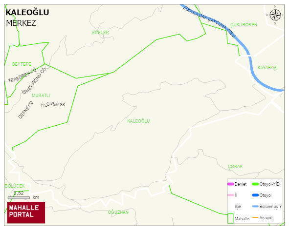
KALEOGLU Village Digital Map | Satellite View and Local Boundaries
KALEOGLU Village – Population, Postal Code, Number of Workplaces
KALEOGLU village MERKEZ district of ZONGULDAK province. UAVT (National Address Database Code) Village Code: 34327. Postal Code: 67980. KALEOGLU 11 streets and avenues, 10 independent business licensed apartments, 460 residential licensed apartments, 217 households. 494 people live in this settlement. 244 male, 250 female. 73 people have never married, 302 people are married, 26 people are divorced and 54 people have passed away. The number of people aged 60 and over is 234. The population rate of 60+ people is % 47 and the ratio of children under the age of 10 to the population is % 3
Leave a Comment