KALINPELIT Village Digital Map | Detailed Villages and Neighbourhoods
Çorum ilinde,
Bayat ilçesinde, köyler içinde,
Gelir seviyesi yüksek bireylerin merkezi listesinde 4. Kalınpelit istatistiklere göre dördüncü basamakta yer alır.
Bağımsız yaşayan nüfusta lider listesinde 3. Kalınpelit şehir içi sıralamada 3. sıradadır.
Bayat ilçesinde, köyler içinde,
Gelir seviyesi yüksek bireylerin merkezi listesinde 4. Kalınpelit istatistiklere göre dördüncü basamakta yer alır.
Bağımsız yaşayan nüfusta lider listesinde 3. Kalınpelit şehir içi sıralamada 3. sıradadır.
| Adi | KALINPELIT Province Affiliated | ÇORUM District Affiliated | BAYAT Postal code | 19802 Number of Streets | 5 Population Density km2-people | 21.78 Number of Apartments with business Licenses | 6 Number of Apartments with Residential Licenses | 179 Number of Households / Families | 84 Total Population | 232 Male Population | 129 Woman Population | 103 Income Per Person - Spendable TL-Month | 5.857 |
|---|
KALINPELIT Village Map | Mountains, Rivers and Elevation Details
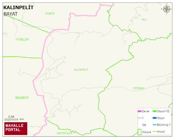
KALINPELIT Village Digital Map | Detailed Villages and Neighbourhoods
KALINPELIT Village – Population, Postal Code, Number of Workplaces
KALINPELIT village BAYAT district of ÇORUM province. UAVT (National Address Database Code) Village Code: 9328. Postal Code: 19802. KALINPELIT 5 streets and avenues, 6 independent business licensed apartments, 179 residential licensed apartments, 85 households. 310 people live in this settlement. 163 male, 147 female. 60 and over is 80. The population rate of 60+ people is % 25
Leave a Comment