KAPILI Village Digital Map | All Neighbourhoods and Settlements
Muş ilinde,
Korkut ilçesinde, köyler içinde,
Aile yaşamının en yoğun olduğu listesinde 5. Kapılı istatistiksel sıralamada beşinci konumdadır.
Konut kapasitesi en geniş listesinde 3. Kapılı kayıtlarda 3. sırada yer almıştır.
Evlilik yapmayanların en çok olduğu listesinde 2. Kapılı sıralamada ikinci sırada yer alır.
Yaş alan bireylerin yoğun yaşadığı listesinde 4. Kapılı istatistik listelerinde 4. sıradadır.
| Adi | KAPILI Province Affiliated | MUS District Affiliated | KORKUT Postal code | 49802 Number of Streets | 1 Population Density km2-people | 43.49 Number of Apartments with business Licenses | 2 Number of Apartments with Residential Licenses | 296 Number of Households / Families | 192 Total Population | 912 Male Population | 452 Woman Population | 460 Income Per Person - Spendable TL-Month | 4.224 |
|---|
KAPILI Village Map | Mountains, Rivers and Elevation Details
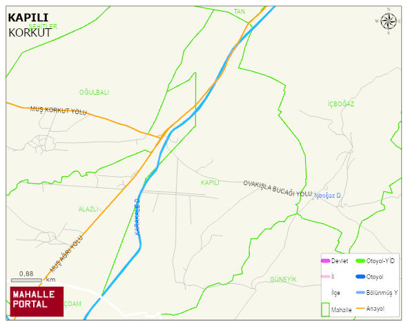
KAPILI Village Digital Map | All Neighbourhoods and Settlements
KAPILI Village – Population, Postal Code, Number of Workplaces
KAPILI village KORKUT district of MUS province. UAVT (National Address Database Code) Village Code: 24826. Postal Code: 49802. KAPILI 1 streets and avenues, 2 independent business licensed apartments, 292 residential licensed apartments, 195 households. 946 people live in this settlement. 467 male, 479 female. 60 and over is 127. The population rate of 60+ people is % 13 and the ratio of children under the age of 10 to the population is % 16 KORKUT -in the district- 9. the most crowded neighbourhood.
Leave a Comment