| Adi | KARAAGAÇ Province Affiliated | KOCAELI District Affiliated | KANDIRA Postal code | 41600 Number of Streets | 42 Population Density km2-people | 130.56 Number of Apartments with business Licenses | 106 Number of Apartments with Residential Licenses | 1383 Number of Households / Families | 549 Total Population | 1535 Male Population | 769 Woman Population | 766 Income Per Person - Spendable TL-Month | 9.564 |
|---|
KARAAGAÇ Neighbourhood Map | Boundaries of Villages
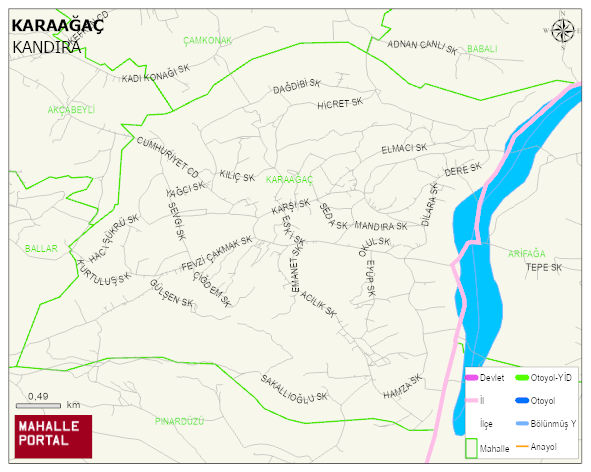
KARAAGAÇ Neighbourhood Digital Map | All Neighbourhoods and Settlements
KARAAGAÇ Neighbourhood – Population, Postal Code, Number of Workplaces
KARAAGAÇ neighborhood is located in KANDIRA district of KOCAELI province. UAVT (National Address Database Code) Neighborhood Code: 585257. Postal Code: 41600. The population density is -per square kilometer- 131 people. KARAAGAÇ 42 streets and avenues, 98 independent business licensed apartments, 1317 residential licensed apartments, 545 households. 1549 people live in this settlement. 780 male, 769 female. 248 people have never married, 898 people are married, 46 people are divorced and 92 people have passed away. The number of people aged 60 and over is 410. The population rate of 60+ people is % 26 and the ratio of children under the age of 10 to the population is % 10 KANDIRA -in the district- 7. the most crowded neighbourhood.
Leave a Comment