KARAAGIL Village Digital Map | Satellite View and Local Boundaries
Muş ilinde, köyler içinde,
En fazla sokağa sahip listesinde 2. Karaağıl ortalamanın çok üzerinde performans gösterdi.
Bulanık ilçesinde, köyler içinde,
En fazla nüfus barındıran listesinde 3. Karaağıl sıralamada üçüncü sırada yer almaktadır.
Maddi refahı zirvede olan listesinde 3. Karaağıl kayıtlarda üçüncü sırada gözükür.
Hane yoğunluğu lider listesinde 3. Karaağıl 3. sırada konumlanan önemli bir yerleşimdir.
En fazla konuta sahip listesinde 3. Karaağıl sıralamada üçüncü sırada yer almaktadır.
En çok işletmenin bulunduğu listesinde 1. Karaağıl istatistiklere göre en üst sıradadır.
En fazla sokağa sahip listesinde 1. Karaağıl istatistiklere göre listenin başında bulunur.
| Adi | KARAAGIL Province Affiliated | MUS District Affiliated | BULANIK Postal code | 49502 Number of Streets | 49 Population Density km2-people | 35.92 Number of Apartments with business Licenses | 19 Number of Apartments with Residential Licenses | 419 Number of Households / Families | 281 Total Population | 1330 Male Population | 675 Woman Population | 655 Income Per Person - Spendable TL-Month | 6.309 |
|---|
KARAAGIL Village Map | All Neighbourhoods and Settlements
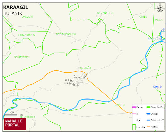
KARAAGIL Village Digital Map | Satellite View and Local Boundaries
KARAAGIL Village – Population, Postal Code, Number of Workplaces
KARAAGIL village BULANIK district of MUS province. UAVT (National Address Database Code) Village Code: 24772. Postal Code: 49502. KARAAGIL 49 streets and avenues, 19 independent business licensed apartments, 418 residential licensed apartments, 301 households. 1466 people live in this settlement. 727 male, 739 female. 60 and over is 147. The population rate of 60+ people is % 10 and the ratio of children under the age of 10 to the population is % 21
Leave a Comment