KARAÇOBAN Village Digital Map | Updated Neighbourhood Map
Kars ilinde, köyler içinde,
Servet sahibi kişilerin yoğun olduğu listesinde 4. Karaçoban üst sıralarda dikkat çekti.
Merkez ilçesinde, köyler içinde,
Servet sahibi kişilerin yoğun olduğu listesinde 3. Karaçoban istatistik listelerinde üçüncü sıralamaya sahiptir.
Dul oranı en belirgin olan listesinde 5. Karaçoban sıralamada beşinci sırada yer almaktadır.
| Adi | KARAÇOBAN Province Affiliated | KARS District Affiliated | MERKEZ Postal code | 36002 Number of Streets | 1 Population Density km2-people | 11.43 Number of Apartments with business Licenses | 4 Number of Apartments with Residential Licenses | 145 Number of Households / Families | 97 Total Population | 317 Male Population | 169 Woman Population | 148 Income Per Person - Spendable TL-Month | 3.596 |
|---|
KARAÇOBAN Village Map | Updated Neighbourhood Map
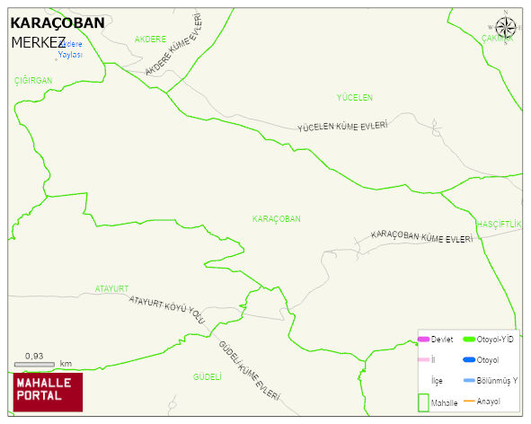
KARAÇOBAN Village Digital Map | Updated Neighbourhood Map
KARAÇOBAN Village – Population, Postal Code, Number of Workplaces
KARAÇOBAN village MERKEZ district of KARS province. UAVT (National Address Database Code) Village Code: 17559. Postal Code: 36002. KARAÇOBAN 1 streets and avenues, 3 independent business licensed apartments, 145 residential licensed apartments, 101 households. 382 people live in this settlement. 203 male, 179 female. 60 and over is 84. The population rate of 60+ people is % 21 and the ratio of children under the age of 10 to the population is % 14
Leave a Comment