KARADIREK Village Digital Map | Geography and Natural Features
Afyonkarahisar ilinde,
Sandıklı ilçesinde, köyler içinde,
Konut hacmi en yüksek listesinde 5. Karadirek 5. sırada olmasıyla öne çıkar.
Değerli arsa bölgeleri arasında listesinde 4. Karadirek dördüncü sırada bulunmasıyla dikkat çeker.
ATM ağı en yaygı listesinde 5. Karadirek istatistiksel olarak beşinci sıradadır.
Yaşlılık oranı en yüksek bölgeler listesinde 1. Karadirek istatistiklere göre en üst sıradadır.
| Adi | KARADIREK Province Affiliated | AFYONKARAHISAR District Affiliated | SANDIKLI Postal code | 03502 Number of Streets | 35 Population Density km2-people | 17.35 Number of Apartments with business Licenses | 46 Number of Apartments with Residential Licenses | 732 Number of Households / Families | 208 Total Population | 444 Male Population | 201 Woman Population | 243 Income Per Person - Spendable TL-Month | 5.189 |
|---|
KARADIREK Village Map | Updated Neighbourhood Map
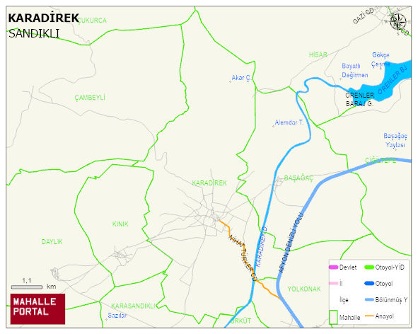
KARADIREK Village Digital Map | Geography and Natural Features
KARADIREK Village – Population, Postal Code, Number of Workplaces
KARADIREK village SANDIKLI district of AFYONKARAHISAR province. UAVT (National Address Database Code) Village Code: 1368. Postal Code: 3502. KARADIREK 35 streets and avenues, 44 independent business licensed apartments, 731 residential licensed apartments, 217 households. 459 people live in this settlement. 206 male, 253 female. 58 people have never married, 275 people are married, 15 people are divorced and 84 people have passed away. The number of people aged 60 and over is 244. The population rate of 60+ people is % 53 En yasli 600 mahalle ve köyden biridir. (Nüfusu 250den büyük 29000 köy ve mahalle içinde)
Leave a Comment