Digital Map
Osmaniye ilinde,
Kadirli ilçesinde, köyler içinde,
Nüfusu en fazla listesinde 2. Karakütük sıralamada ikinci sırada yer almaktadır.
En geniş aile yerleşimi listesinde 2. Karakütük sıralamada ikinci sırada yer almaktadır.
Mesken sayısı bakımından öne çıkan listesinde 4. Karakütük 4. sırada kayıtlı, bölgenin önde gelen yerleşimlerinden biridir.
| Adi | KARAKÜTÜK Province Affiliated | OSMANIYE District Affiliated | KADIRLI Postal code | 80752 Number of Streets | 10 Population Density km2-people | 28.74 Number of Apartments with business Licenses | 8 Number of Apartments with Residential Licenses | 797 Number of Households / Families | 443 Total Population | 1226 Male Population | 631 Woman Population | 595 Income Per Person - Spendable TL-Month | 5.381 |
|---|
KARAKÜTÜK Village Map | Updated Neighbourhood Map
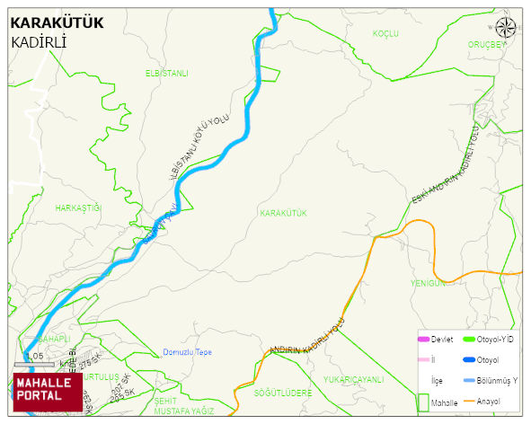 KARAKÜTÜK Köyü Haritası | Sayısal Bölge Görünümü
Digital Map
– Population, Postal Code, Number of Workplaces
KARAKÜTÜK village KADIRLI district of OSMANIYE province. UAVT (National Address Database Code) Village Code: 37269. Postal Code: 80752. KARAKÜTÜK 10 streets and avenues, 8 independent business licensed apartments, 785 residential licensed apartments, 433 households. 1230 people live in this settlement. 627 male, 603 female. 314 people have never married, 637 people are married, 18 people are divorced and 97 people have passed away. The number of people aged 60 and over is 377. The population rate of 60+ people is % 30 and the ratio of children under the age of 10 to the population is % 6
Leave a Comment